
Southern Scenic Route: Part 3 - Fiordland
The Southern Scenic Route is a tourist highway in New Zealand that follows the state highways and links Queenstown, Fiordland to Dunedin via The Catlins.
This is part 3 of a visual story about our 20-day journey following the Southern Scenic Route from Dunedin to Queenstown in early December 2020. This third part covers our trip through Fiordland, including Lake Hauroko, Manapouri, Doubtful Sound and Milford Sound, to Queenstown.
You can find the stories covering parts 1 and 2 here:

On day 13 of our 20-day trip, we explored the centre of Invercargill and headed off towards Fiordland via Riverton, the ‘Riviera’ of Invercargill, where we had a very nice, seaside lunch at the Beachhouse Restaurant consisting of a delicious gluten free Salmon Hash and Eggs Benedict.
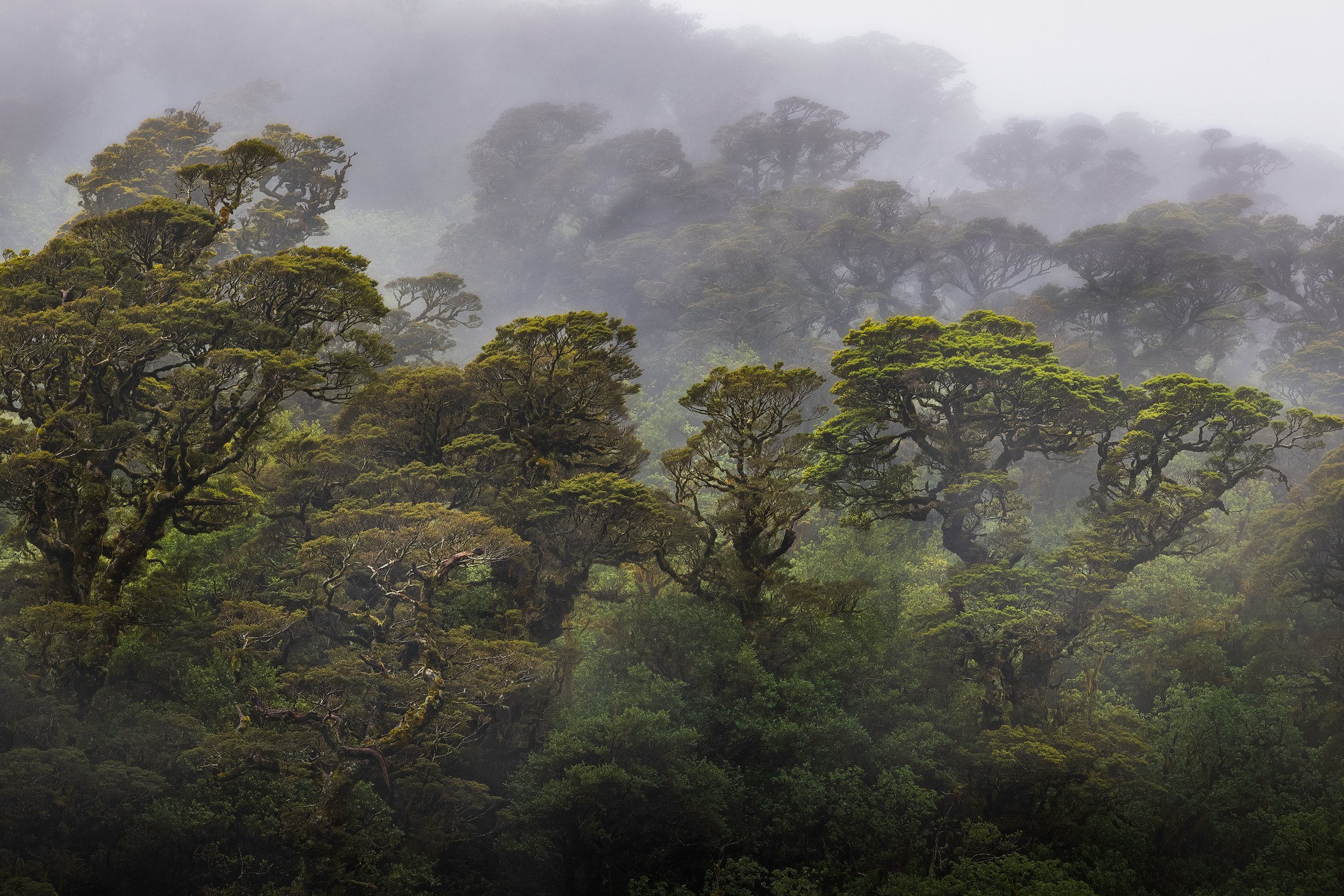
After lunch, our trip in the campervan continued. Driving along Te Waewae Bay towards the west, we briefly stopped at Gemstone Beach and McCracken’s Rest to get a glimpse of Fiordland. Beautiful and dramatic views of the Fiordland mountains as we entered it. And beautiful beech forest all around.


Lake Hauroko
The cloud cover gradually increased as we drove from Invergargill to Lake Hauroko in Fiordland. We arrived at Lake Hauroko, the deepest lake in New Zealand with a depth of 462 metres, just after 5pm. We decided to freedom camp at the park ground close to the lake, so that we wouldn't need to travel that far in the morning for sunrise photos.
As soon as we had arrived at our destination in the late afternoon it started to rain heavily. Luckily the rain stopped at 7am the next morning and when we looked outside our campervan we were very surprised to see the surrounding hills covered in snow considering that it was early summer.

Lake Hauroko Reflection


The parking spot we parked in, had been empty apart from one car with a couple who had damaged the car the night before. But now boaties started to arrive with jet boats (and quite a bit of beer). So after photos, we left the lake to make our way towards Lake Manapouri.
The drive to Manapouri was very enjoyable, with snow covered mountains, the Brunel Peaks, to our right. We found a powered campsite along Lake Manapouri and then it started to rain, producing some very moody lake views. We booked a cruise of Doubtful Sound for the next day, hoping that the weather would clear.
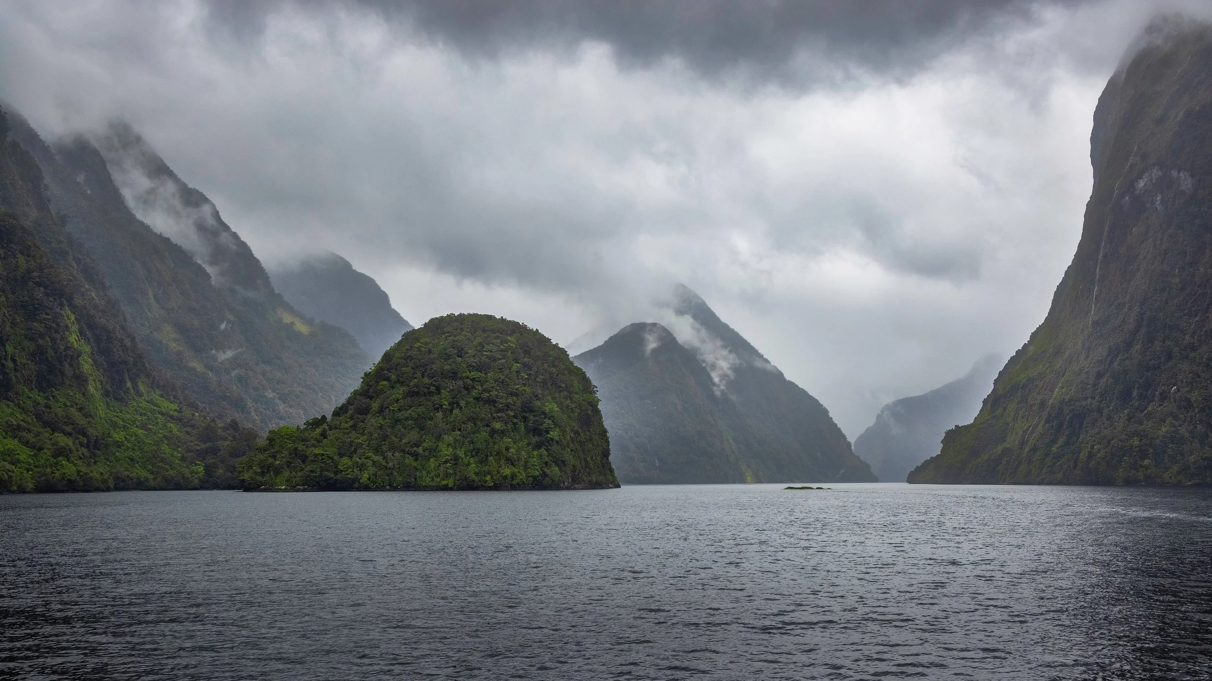
Doubtful Sound
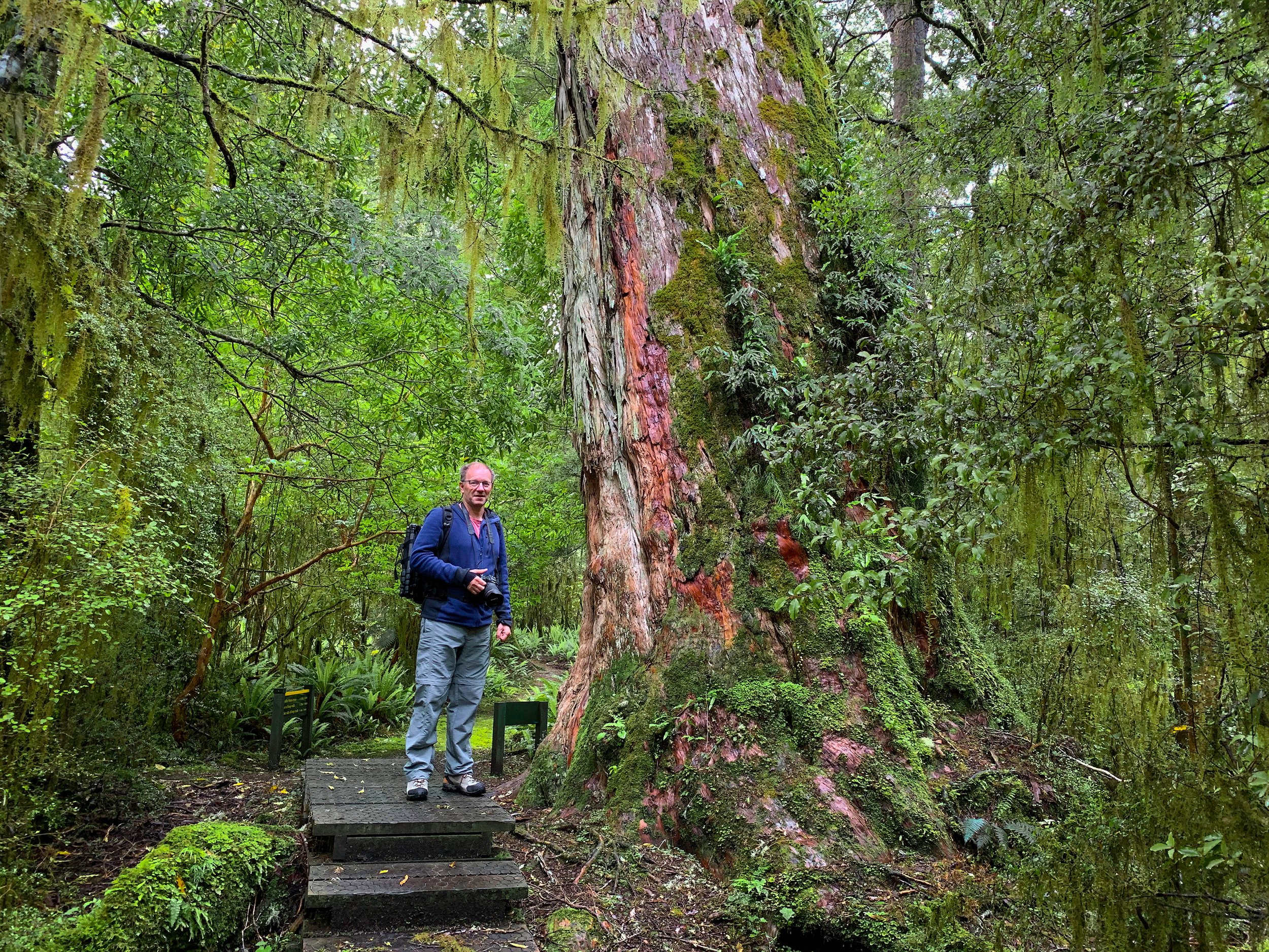
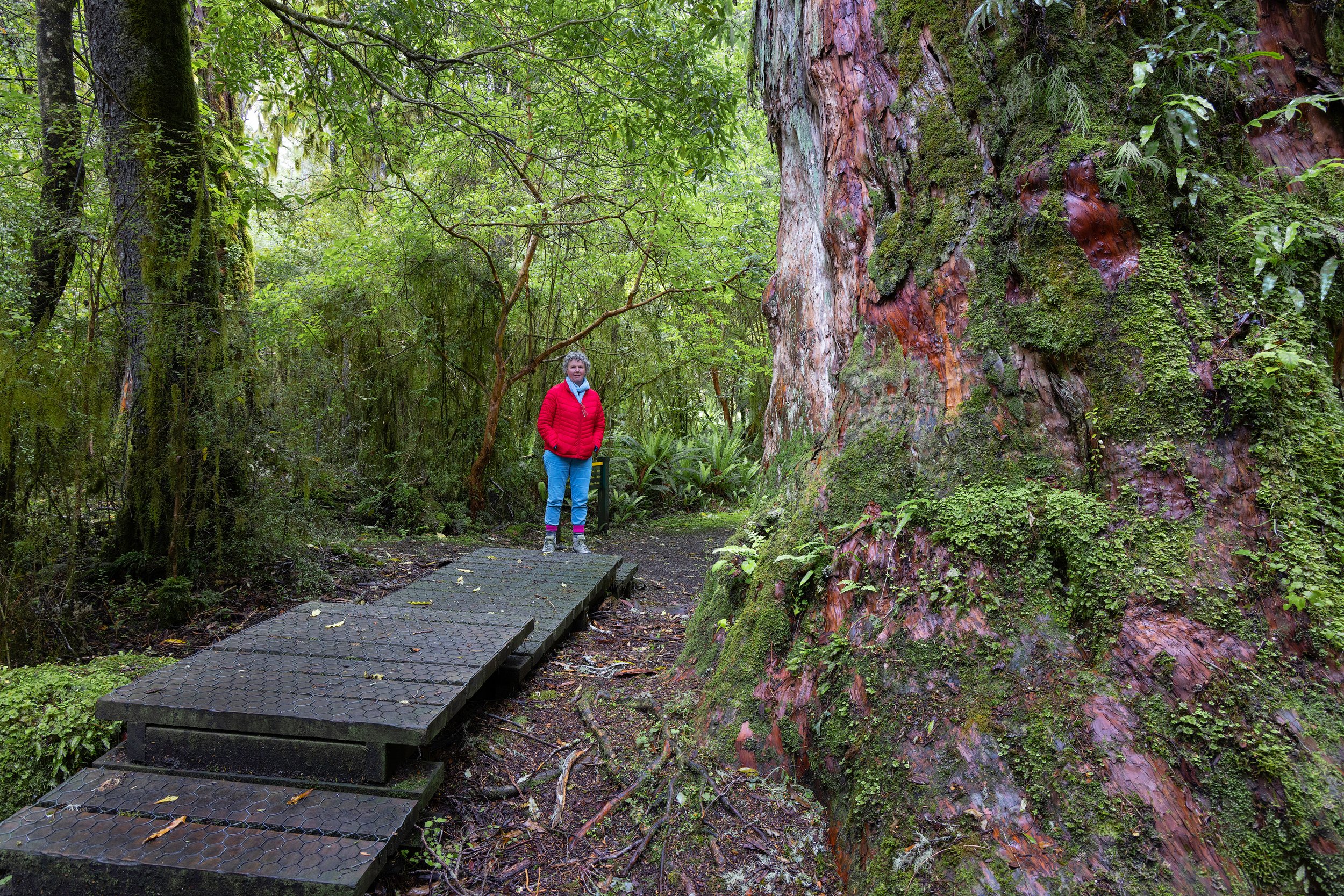
Doubtful Sound / Patea is a 40 kilometres long fiord in Fiordland, and at a depth of 421 metres, it is the deepest of the South Island fiords. Its Maori name, Patea meaning 'place of silence', is very appropriate, because apart from the sound of birds and waterfalls, the dramatic landscape is beautifully silent.
While staying in Manapouri for a few nights, we went on a cruise to experience the spectacular and pristine Doubtful Sound. There’s no direct road access, so the only way you can to get to Doubtful Sound is a cruise across the picturesque Lake Manapouri, followed by a bus trip over Wilmot Pass, New Zealand's most expensive road. From there, we boarded another cruise boat for a 3 hour tour of Doubtful Sound.

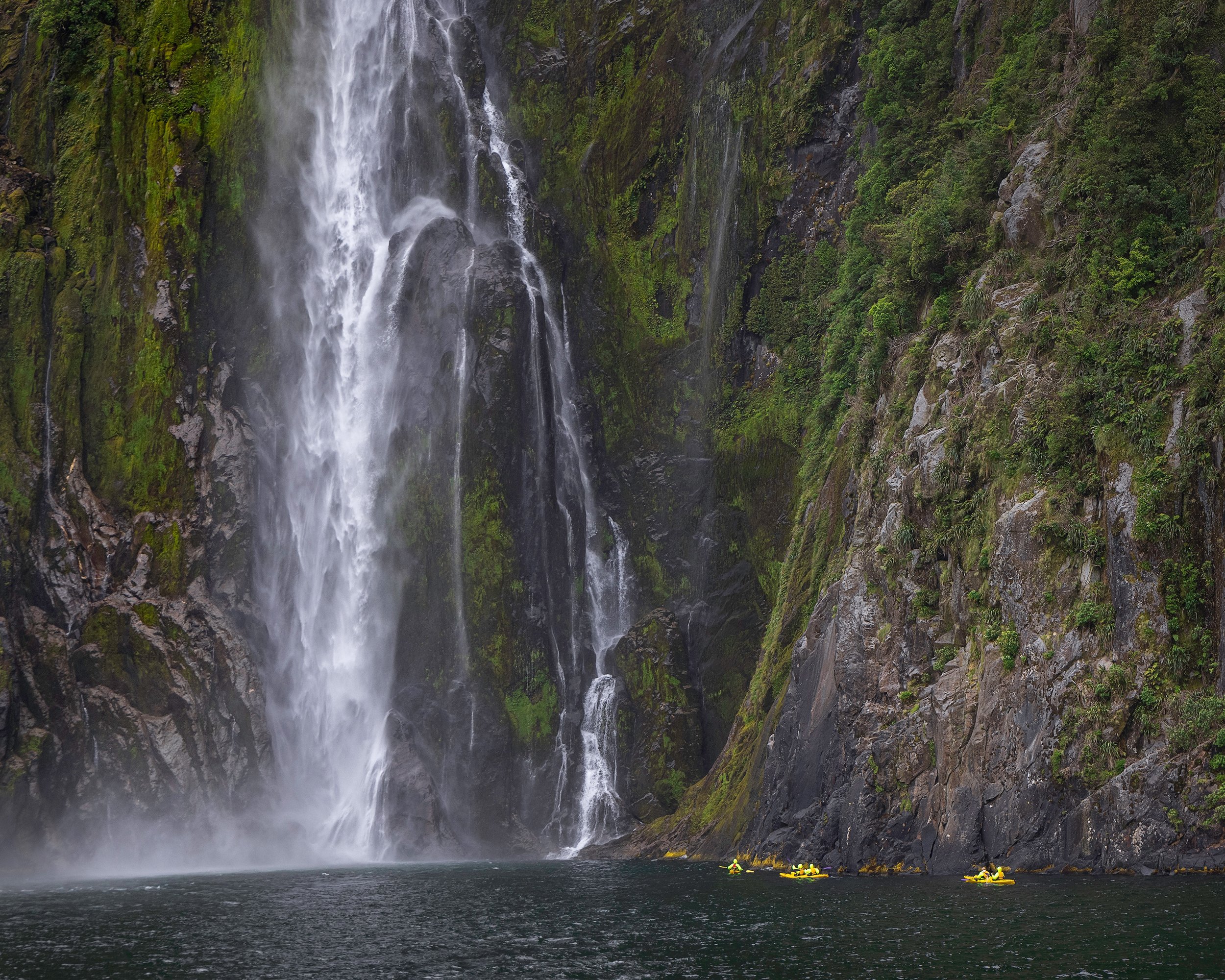
Waterfall in Doubtful Sound
A beautiful waterfall on a cloudy, but unusually dry day in the the Crooked Arm that is one of the arms off the Doubtful Sound, Fiordland, New Zealand


Flowering Rata in Doubtful Sound
Shaped by Glaciers
Is this an island or a sea stack?
Milford Sound
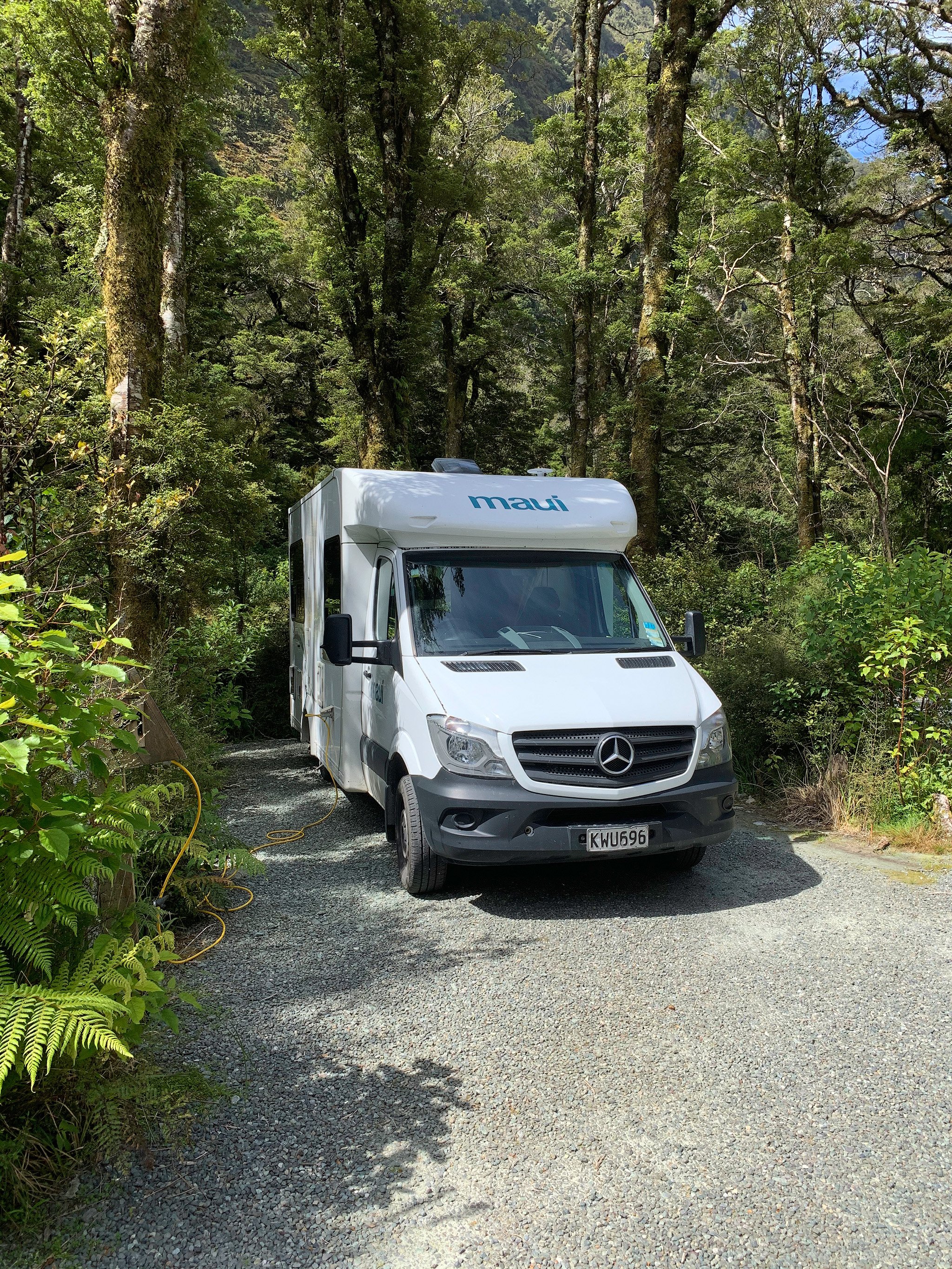
We left Manapouri to drive to Milford Sound via Te Anau where we saw several takahe, rare and flightless native birds of New Zealand, with chicks at the local Bird Sanctuary. The road to Milford Sound passes through stunning landscapes with mountains, streams and native rainforest. I was hoping for moody weather after coming out of the Homer Tunnel, but the skies were very blue, which was great for tourist activities, but not for interesting photographs. We stayed at the Milford Sound Lodge for two nights and we were lucky to have a beautiful spot between the trees.
After our first night I got up before 5:30 to walk 30 minutes to the wharf to take photos of Mitre Peak reflected in the water. I got attacked by swarms of sandflies and had to swing my arms around in front of my lens before every photo. I enjoyed the quietness as there were no people around (thanks Covid-19).

Mitre Peak
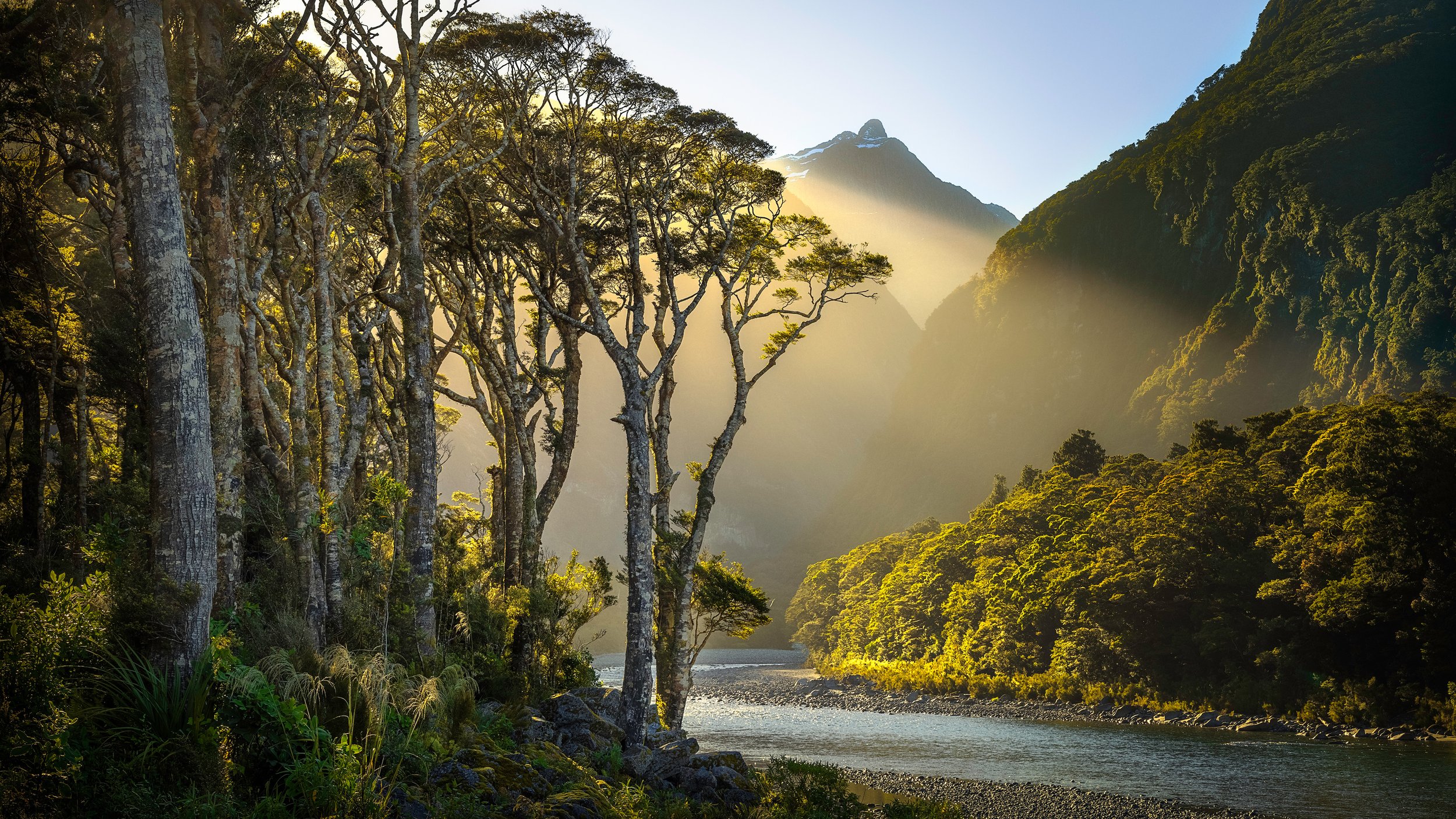
I came across the sight below when walking back from the early morning hike to Mitre Peak. The sun was still low in the sky and this beautiful golden beam of light appeared in front of me that lit up the riverbank and provided a gorgeous backdrop for the silver beech trees.

Silver Beech at the Cleddau River
The early morning sun lights up the trees along the Cleddau River, Milford Sound.
At sunset, I walked towards the wharf for some photos of Mitre Peak. Two locals pointed me to an elevated viewing point that I climbed to capture a panorama of the mountains in the area, framed by native trees.

Milford Sound Panorama
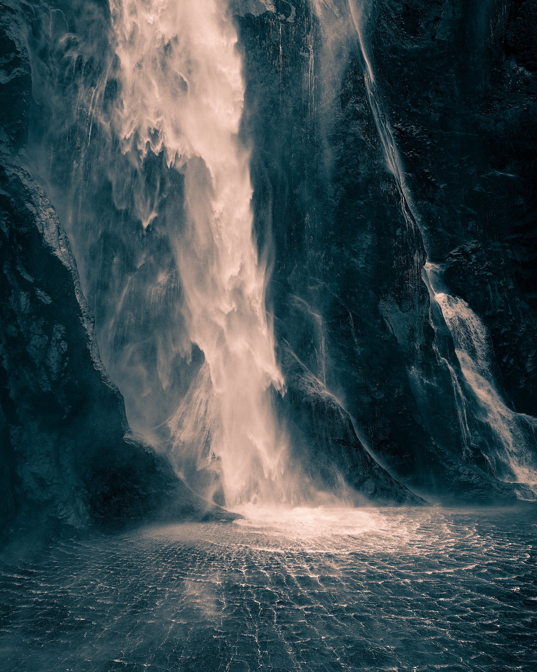
And, of course, we went on a cruise around Milford Sound. Stirling Falls was one of the main attractions of the cruise. The force of this 155 metres high water is simply amazing. Especially when the cruise boat goes so close to it that its bow is almost under the falls, soaking us in seconds.

Fiordland in Duotone
The abundance of cloud and lack of light on the land in Fiordland triggered an experiment with black-and-white and duotone photo processing. I applied an orange and teal colour grade to a number of images that hopefully brings out the mood and majestic-ness of the landscape.

Moody Lake Manapouri

Moody Doubtful Sound Silhouette


First light on Mitre Peak
Time to go home
On day 18 it was time to leave Fiordland behind and make our way to Christchurch to fly back home. We headed towards Queenstown and parked close to the Devil's Staircase for the night to do some freedom camping along Lake Wakatipu.
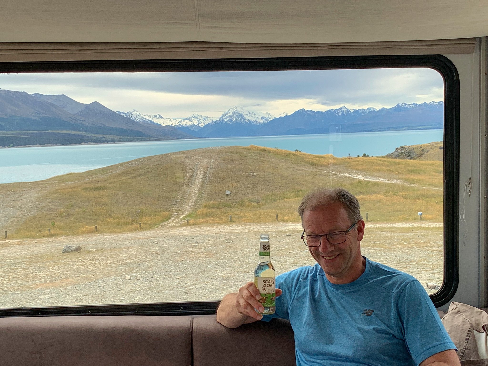
The next day we avoided Queenstown and drove to Lake Pukaki, where we found the best freedom camping spot ever…

Lake Pukaki and Mount Cook Sunset Panorama
A spectacular sunset at Lake Pukaki when the setting sun lit up Mount Cook and the clouds above.

Pastel Colours at Aoraki / Mt. Cook
I took this image at sunrise the following day.
I hope you enjoyed this visual story of our trip. We certainly did!
More articles about the Southern Scenic Route


Other visual stories


This is part 3 of a visual story about a 20-day journey following the Southern Scenic Route from Dunedin to Queenstown in early December 2020. This third part covers our trip through Fiordland, including Lake Hauroko, Manapouri, Doubtful Sound and Milford Sound, to Queenstown.