
Walking the Milford Track
The Milford Track is one of the great, and probably best-known, walks of New Zealand and had been on our bucket list for some time. In December 2021, we (my wife, two sons, and myself) finally walked it. It’s an exciting 4-day hike, starting from a boat launch on Lake Te Anau, wandering through glaciated valleys and over an alpine pass to Milford Sound, an impressive glacier-carved fiord.
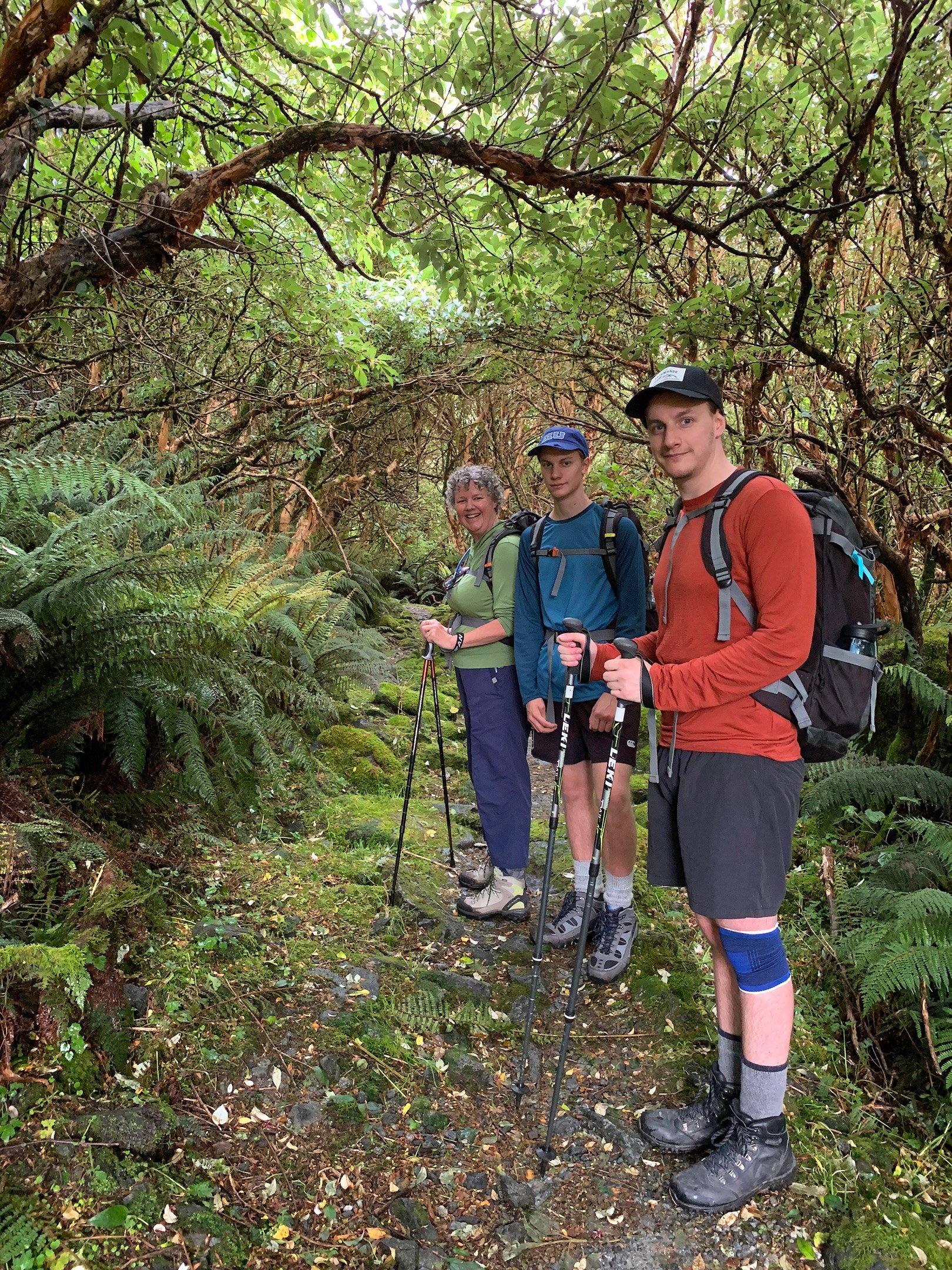
We organised to walk the Milford Track through Ultimate Hikes. They provide a guided walk, and organise the whole trip including facilities and food, so that we didn't need to carry anything with us on the hike (apart from our own clothing). Our packs were still around 10kg, and mine was about 17kg due to the camera gear I was carrying. On day 1, we travelled by bus from Queenstown to Lake Te Anau, where we took a boat to the start of the Milford Track. On days 2, 3, and 4 we walked the track, and on day 5 we went for a cruise on the Milford Sound, and took the bus back to Queenstown.
Day 1: Queenstown to Glade House
Day 1 was Christmas Day 2021. We walked from the Copthorne Hotel to the Ultimate Hikes office with our bags. The previous day we had been there for a pre-trip briefing, and had picked up 3 backpacks and 4 separate bags for personal stuff, that we would have access to once we had arrived in Milford. At about 9am we departed Queenstown in the bus for Te Anau, where we had lunch. We drove a bit further to Te Anau Downs to swap the bus for a boat. The boat would take us to the lake’s northern tip at Glade Wharf, where the Milford Track begins.
Glade Wharf
Glade Wharf is at the northern tip of Lake Te Anau where the Milford Track begins. It is the point where the Clinton River enters the lake.
After being dropped off at Glade Wharf, we walked a short distance (1.6km) to Glade House that was the first ‘hut’ of our trip.
We shared a room with bunks sleeping 6. The room was equipped with towels, blankets, and sheets. We had easy access to power points, so devices and batteries could be charged without having to rely on powerpacks. There were shared facilities, with plenty of toilets and high-pressure hot showers, and a large common room with a bar to sit, play games, have a drink, and dine. Overall, the accommodation was clean and well looked after, more comparable to a quality holiday park than a typical DOC hut. Quite impressive for a place in the middle of nowhere.
After settling in, the guides took us on a short nature walk around the house, and explained a bit about the surrounding flora and conservation initiatives. We saw our first waterfall, and had a last glimpse of Lake Te Anau.
After that, it was time for our Christmas dinner. Our group consisted of 33 people, and we were seated at round tables in the large common area for about 6 people each. A very nice dinner catering for a wide variety of dietary requirements, including Gluten Free and Vegan, with Christmas crackers, and a very nice introduction to tramping with Ultimate Hikes.
After dinner, we had a stroll outside, looking at the Clinton River and Mount Sentinel while the sun was setting.
The generator was turned off at 10pm, and we slept to get up at 7am.
Day 2: Glade House to Pompolona Lodge
We got up quickly to have breakfast and make our lunch to carry with us. There was plenty and a large variety of food, so everyone was happy. I opted to wear shorts rather than trousers, as the sandflies weren’t that bad, and the weather was nice. And then we set off at 8:30am.
We crossed our first swing bridge over the Clinton River. Very nice colourful reflections.

Swing Bridge over the Clinton River
The track was wide and quite smooth gravel. Like a ‘highway’ compared to the rough tracks we hiked in the Kaweka’s and the tracks we would walk on the subsequent days. The track has been used historically by horses and carts to bring supplies from Glade Wharf to further out huts.

The first mile marker
Markers are placed alongside the track that are indicating the distance travelled. There are 33 in total, making the total distance 33.5 miles or 55 kilometres spread over 3 days.
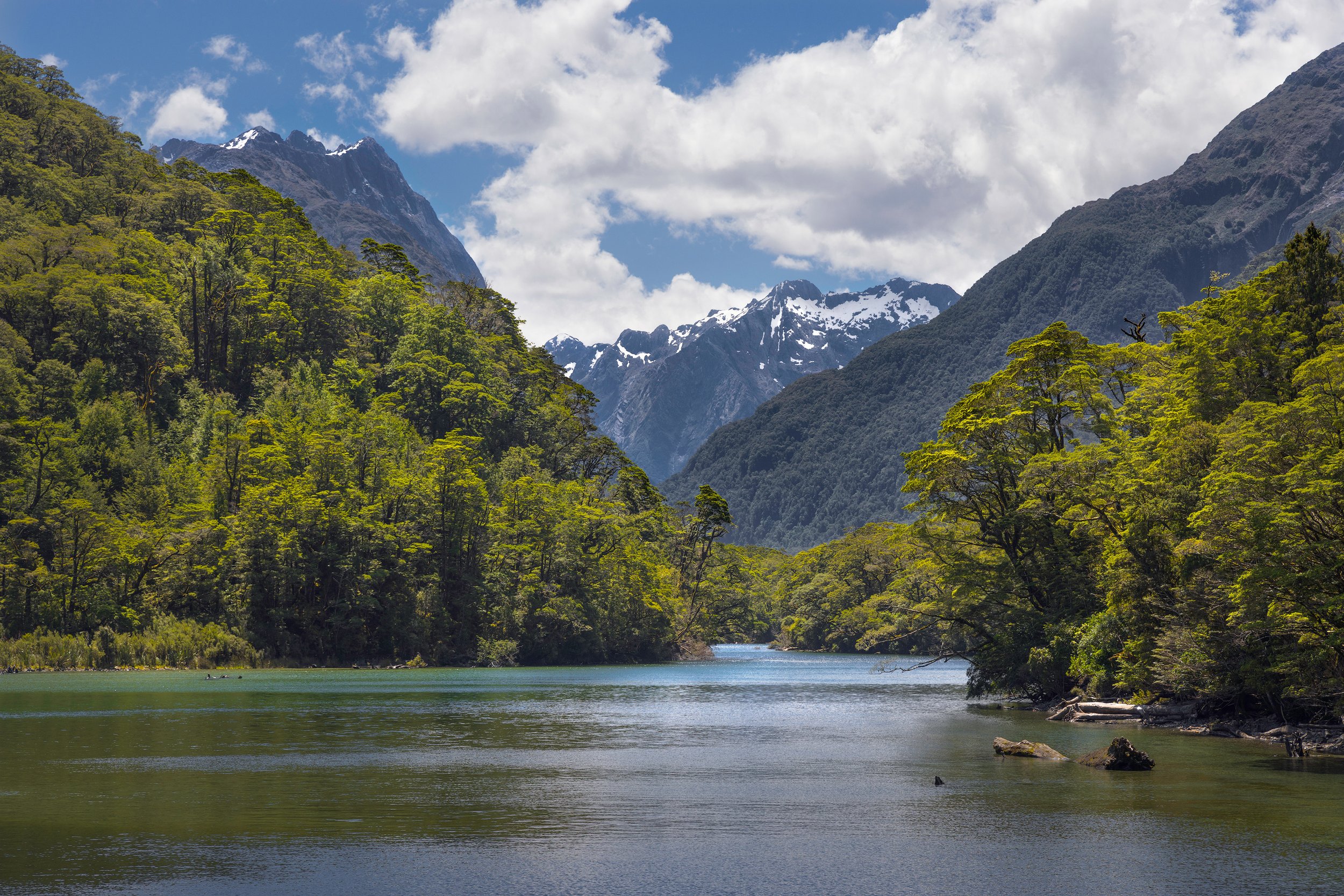
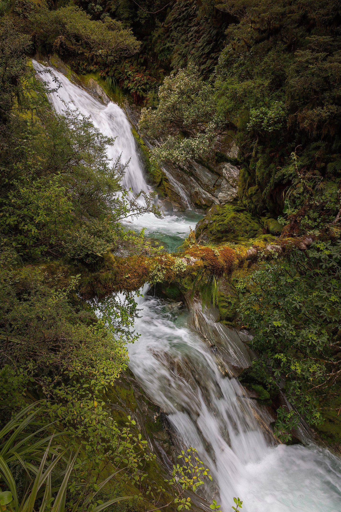
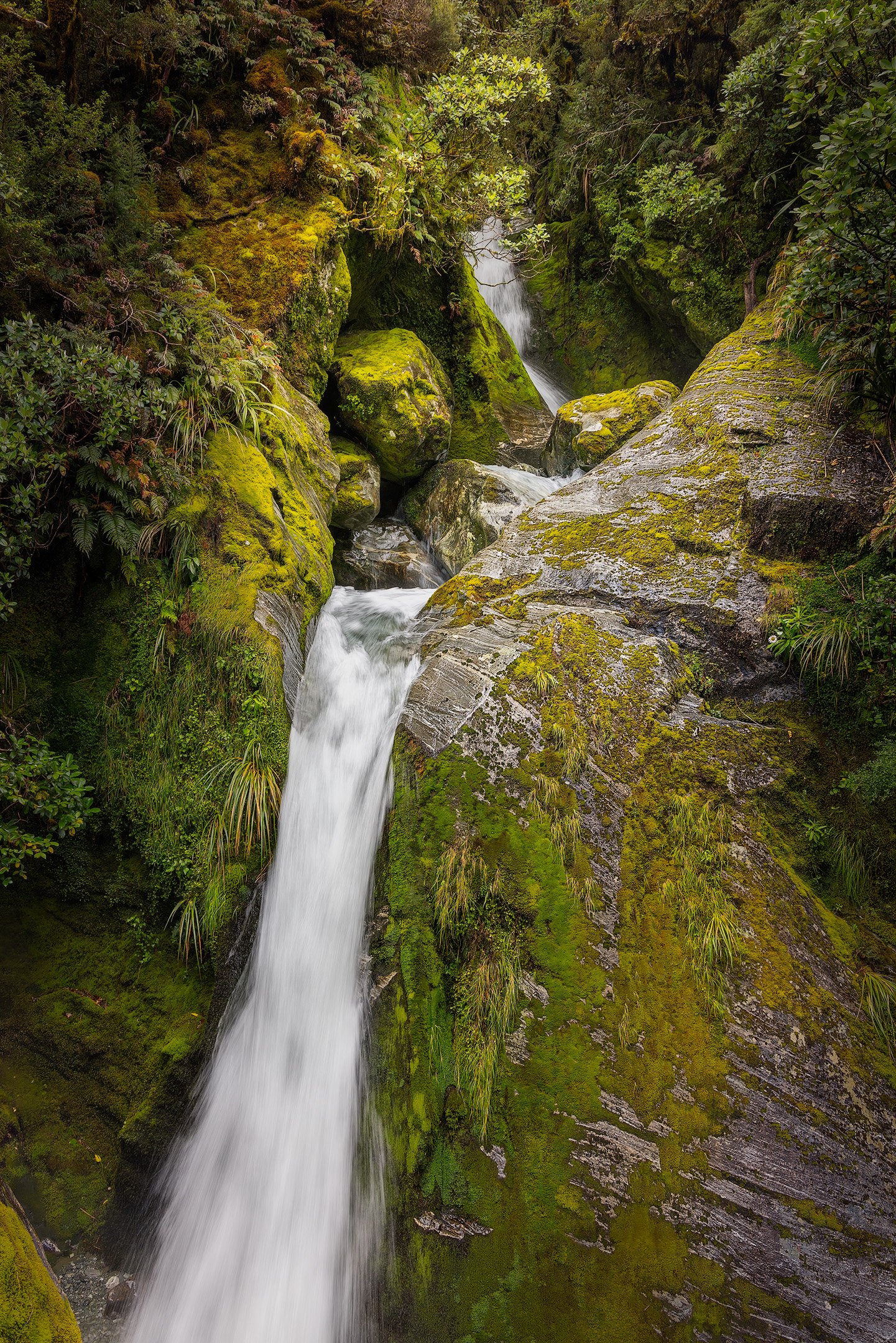
The track meanders alongside the Clinton River and the rainforest just gets better and better. Occasionally, clearings in the rainforest provide views of the river. The river has many different ‘personalities’; sometimes calm and peaceful with very clear water, and sometimes loud and raging through large boulders.
Clinton River
Occasionally, the sun would find a gap in the clouds and light up the trees along the Clinton River.
Clinton Valley Forest Scene
A clearing in the rainforest provides a peek at the Clinton River winding its way through the valley.
The track has small side trips to some lakes and the magnificent, colourful wetlands.

Clinton Valley Wetland Boardwalk
The short walk to and around the wetland boardwalk is definitely worth it as the colourful landscape is so different from the other scenery on the Milford Track.

Clinton Valley Reflection
A view into Clinton Valley taken near the Hidden Lake. The lake in the foreground is not the actual Hidden Lake, but a small unnamed lake/tarn on the track towards the lake and waterfall.

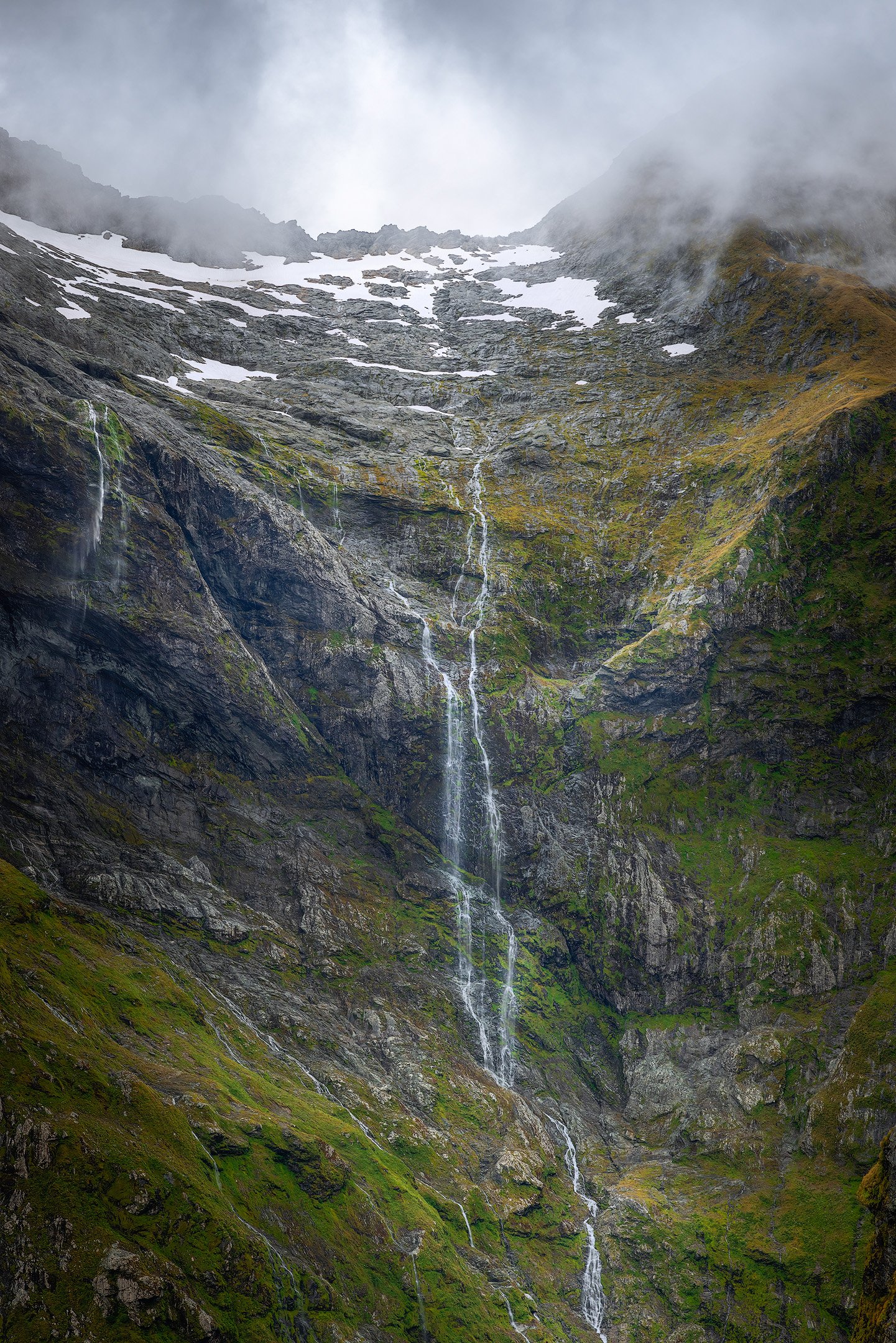
It's coming
The last stretch to Pompolona Lodge on day 2 of walking the Milford Track required navigating large mossy rocks that were the result of an historic avalanche with many waterfalls coming down from the mountain above as the rain was steadily increasing.
We arrived at Pompolona Lodge just after 3pm. We had showers, washed our clothes, and hung them in the very warm dry room. It didn’t take long for them to dry, ready for the next day.
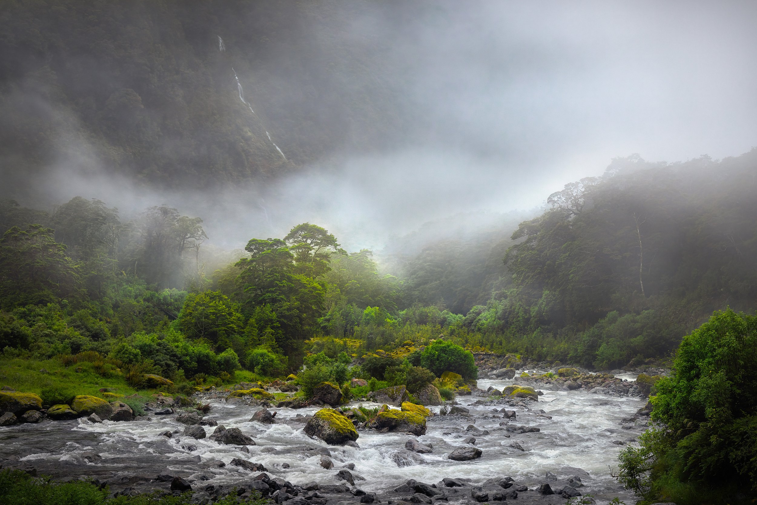
It had been threatening to rain for most of the afternoon, and some light rain had started during our walk, but it began to really bucket down once we had arrived at the lodge. It created lots of waterfalls that were cool to watch. The guides said it would stop during the night, and it did.
The generator went out at 9:30pm and we slept until 6am, because we had an early start the next day.
Day 3: Pompolona Lodge to Quintin Lodge
This was going to be a big day because we had to climb the MacKinnon Pass. We left the lodge at about 7:30am (after breakfast and making our lunch). And, as predicted, the rain had stopped.
As we started day 3 of the Milford Track, the Clinton Valley was shrouded in mist, which was the remainder of the heavy rain that had fallen during the night. The mist gradually lifted, revealing the green valley and fast-flowing Clinton River with waterfalls running down the steep glacier-shaped mountain sides.
Early morning mist in the Clinton Valley
As you gain in elevation while walking up the Clinton Valley, the vegetation gradually changes, and you are offered great views of the Clinton Valley. This valley is a wild and dramatic place, where you’ll be dwarfed by the sheer scale of the rock walls towering above on either side.

Shaped by Glaciers
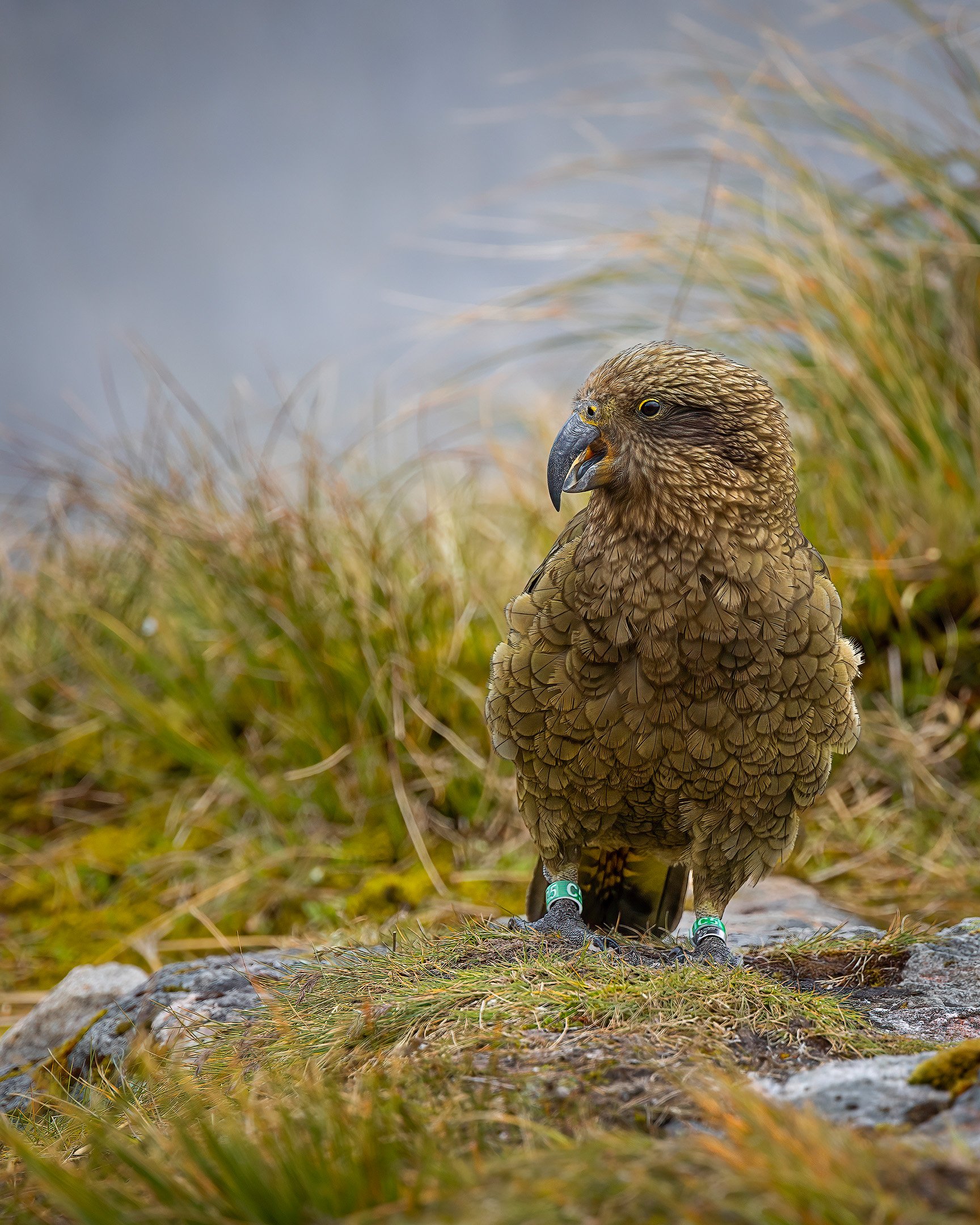
The rain hadn’t changed the tracks much, and the beginning of the walk was comparable to the day before. But after coffee at the Mintaro Hut, the climb started. Before we started the climb though, we had an encounter with a Kea who was putting on a show at the hut.

Kea Close Up
This juvenile kea visited us at the Mintaro Hut where we had morning tea before climbing to the top of the Mackinnon Pass. We met him (and his name is Matariki 7) again at lunch time at the Pass Hut (we checked the kea’s tag afterwards).
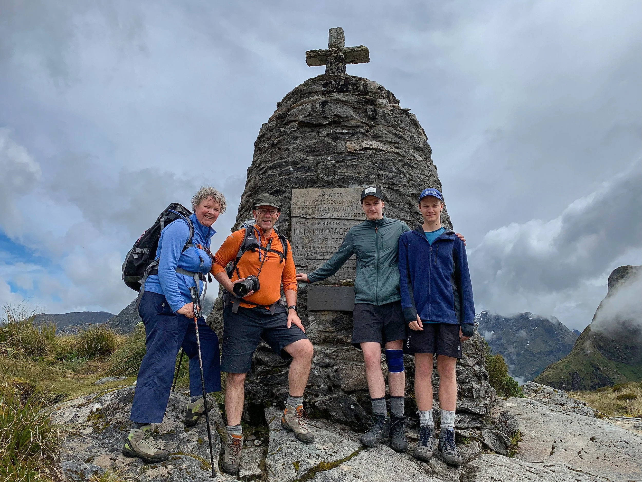
The gradual zigzag climb to reach MacKinnon Memorial was hard work, but beautiful. The mountain views are spectacular, and the flora along the track up MacKinnon Pass is quite nice, sometimes looking like a garden. We even spotted an old garden rake along the track. The climb took us about 4 hours. This was the highest point of the track at 1154 metres.
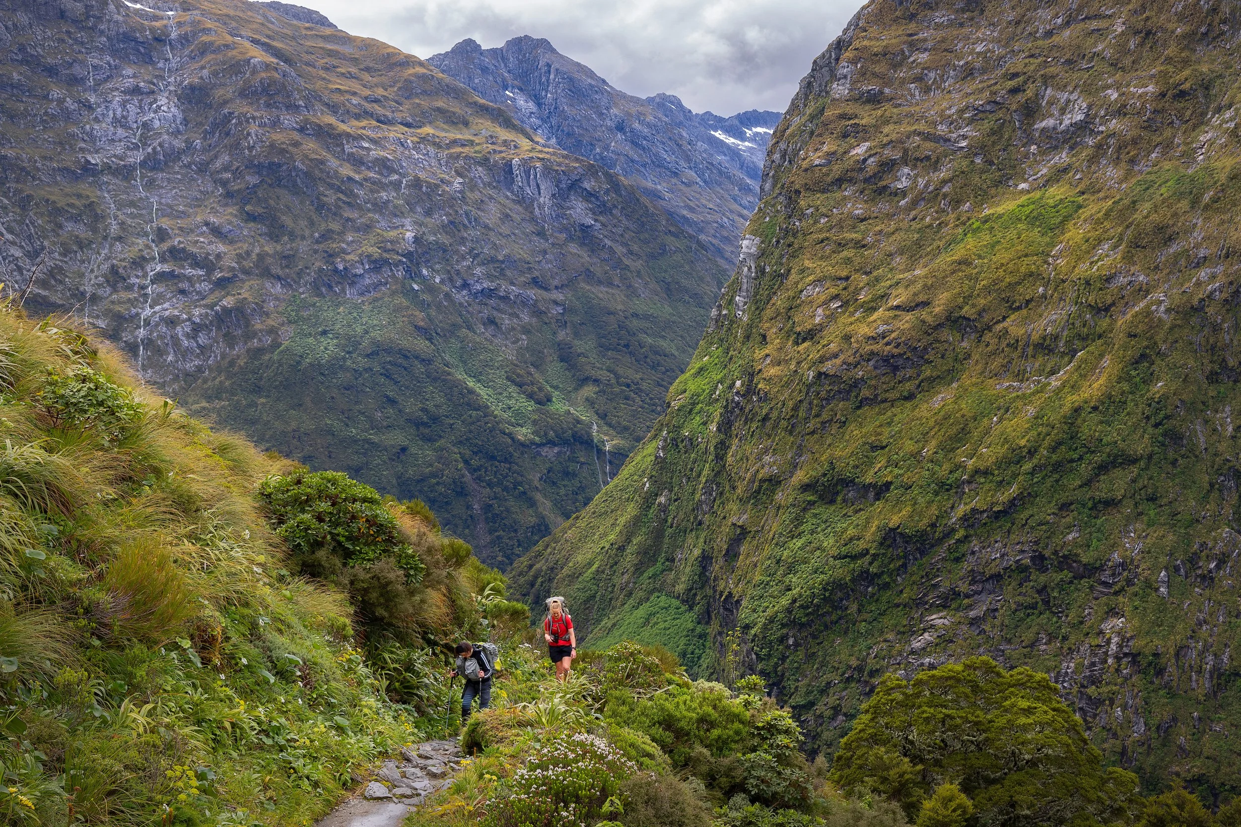
Debbie, one of our four guides, and a fellow tramper walking up MacKinnon Pass.
Clinton Valley from the MacKinnon Pass
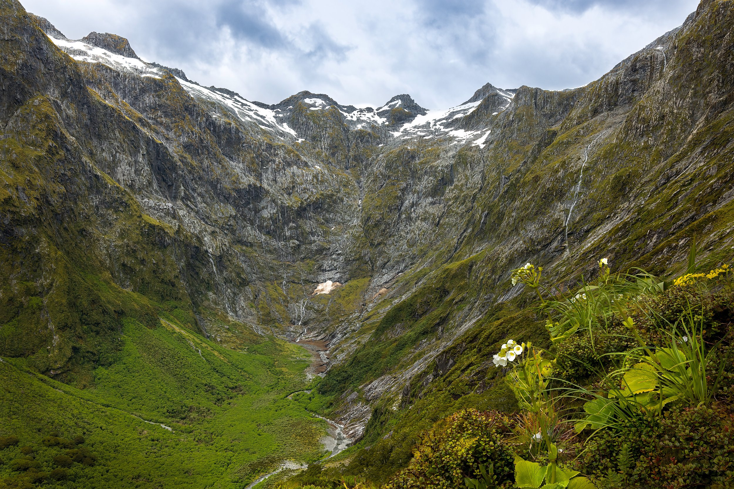
Nicholas Cirque
A view of Nicholas Cirque, which is a ring of glacial mountains at the head of the valley that is followed when heading northbound to the Mackinnon Pass.

Mount Hart at MacKinnon Pass
Looking up towards Mount Hart with three small lakes in the foreground. The MacKinnon Memorial is visible in the centre just above the biggest lake.
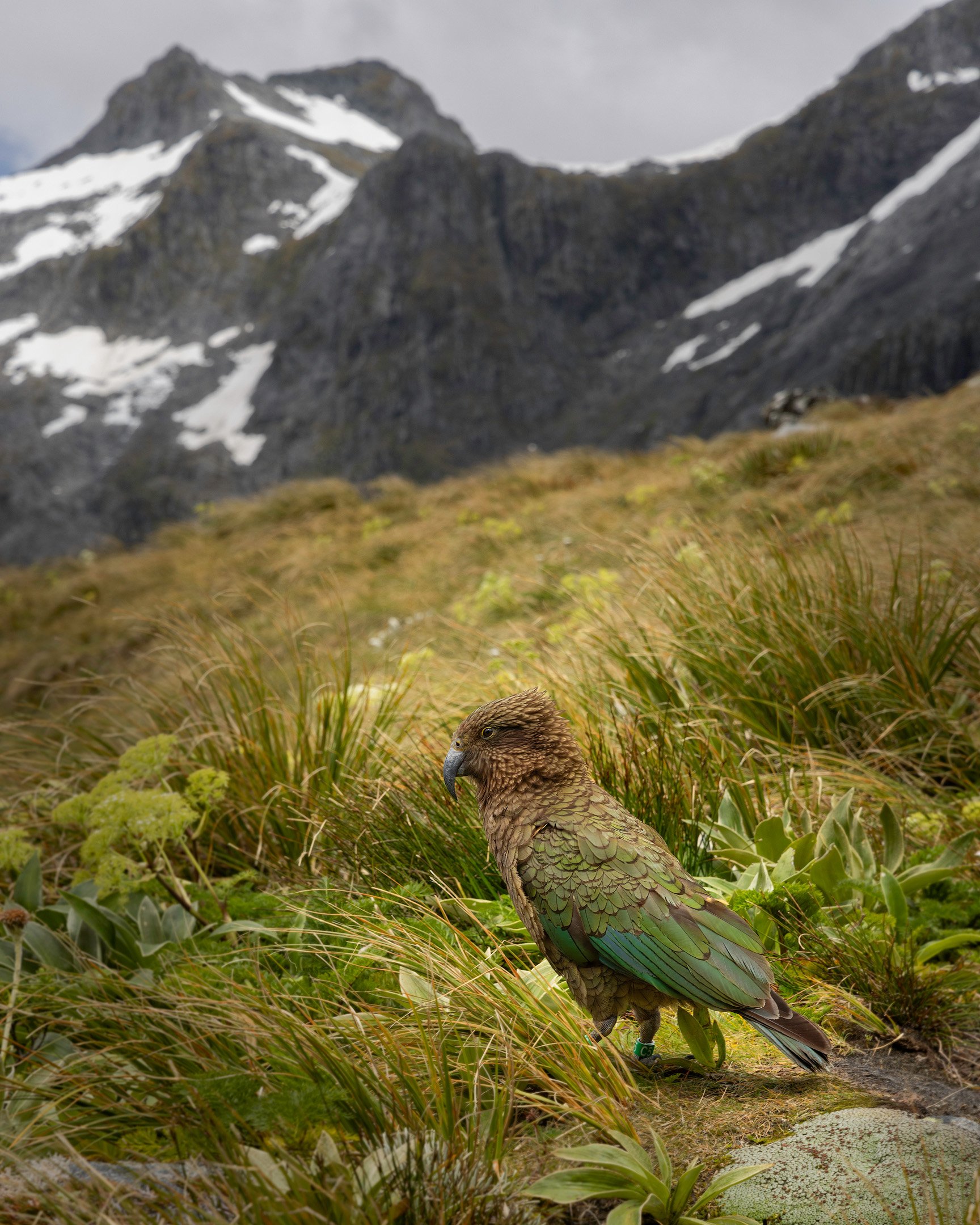
And look who visited us again while we were having lunch in the MacKinnon Pass Shelter!
We had to take the Emergency Track down as the main track was closed. It is quite steep in places with deep drops from rocks/tree roots that were hard on the legs. This was comparable with the difficult parts we had done on other hikes in the Kaweka’s. It would have been bloody hard if it had been very wet, but it was dry with the sun occasionally peeking out.
From the pass to Quintin Hut, the track drops 870m over a span of 7km (not sure if it’s the same for the Emergency Track as that is shorter).
After the Emergency Track we reached the Roaring Burn River (or stream) with lots of water coming down and many beautiful waterfalls and rapids. Very impressive sight and we followed it for quite some time, often on wooden and metal stairways and lookout platforms along the valley beside the water. It was hard to distinguish the various waterfalls, cascades, etc. from each other!

Sutherland Falls
After arriving at Quintin Lodge, we went to Sutherland Falls before 4:30pm, which was the cut-off time. About 90 minutes return, but we went quite fast and did it quicker. We got very wet there as the spray was enormous. Too wet to take a good photo.
Day 4: Quintin Lodge to Mitre Peak Lodge
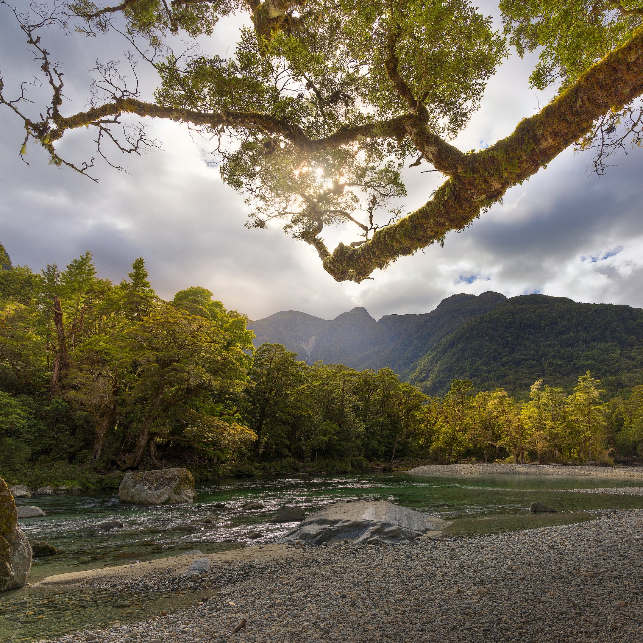
The last day of walking is 21km long on a mostly well graded track but with some uneven and rocky patches. The track follows the Arthur River to Milford Sound via Lake Ada. It’s a day of more waterfalls (even though it was not raining).

Mackay Falls
Mackay Falls is the first waterfall we saw on the 4th day of the track. It's a beautiful cascade waterfall.

A small forest stream with a tiny waterfall
We had lunch at the Giant Gate Falls where we were joined by a Weka hoping for a feed. From there it’s a wide and straightforward track to Sandfly Point, and we became focussed on getting to the end.

Giant Gate Falls
The Giant Gate Falls are part of a tributary river that feeds the main Arthur River that flows into Lake Ada.

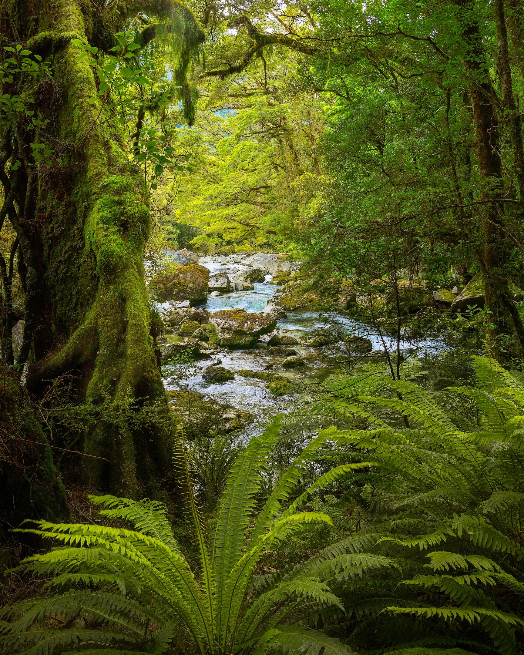
Clearing in the forest
A view of the Arthur River with ferns in the foreground.
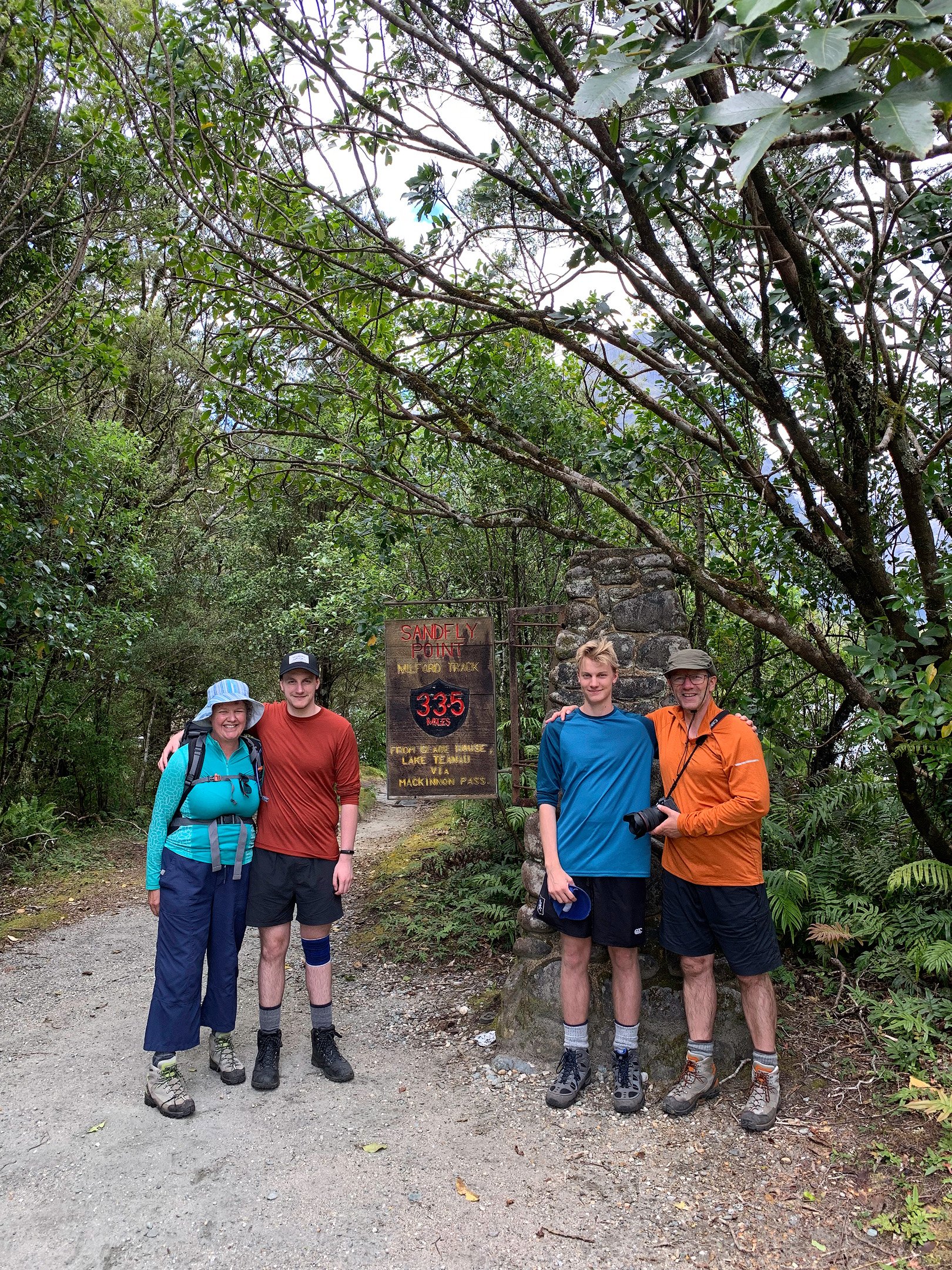
We reached Sandfly Point, the end of the Milford Track just before 3:30pm. We walked 33.5 miles or 55 kilometres in 3 days. We took the obligatory family photo at the 33.5 miles marker and took a small ferry to the Mitre Peak Lodge in Milford.
Day 5: Milford Sound
After a nice night in the Mitre Peak Lodge, it was time to get up, ignore our complaining muscles, and admire the beauty of the Milford Sound. Luckily, the weather was cooperating and it was a sunny and calm start to the day.

Milford Sound Reflection
The waters of the fiord are a deep blue, reflecting the surrounding mountain peaks, including the iconic Mitre Peak, and the sky above, creating a breathtakingly beautiful scene.

Mitre Peak Reflection
Taken during a very calm start of the day, the reflection of Mitre Peak in the Milford Sound was just begging for a symmetrical composition.
I hope you enjoyed reading and viewing the journal of our trip. We definitely enjoyed it!
Gear and Handy Stuff
The camera gear I brought on the trip:
iPhone (quick snapshots and movies)
Canon EOS R5
3x lenses
3x 128GB memory cards (only used one)
3x Canon batteries (used 2)
No tripod and no filters
I used a new Atlas Athlete Backpack:
Had enough room for all camera gear, plus clothing.
Was very comfortable to carry for the whole day
Had the rain cover on for a short time during light rain, so it wasn’t fully tested. I have tested it on subsequent trips and it is rainproof.
Would be difficult to carry all stuff if going on a self-sufficient trip that would require all food, sleeping bag, etc.
Useful Apps and Websites:
An iOS App (one for the South Island and one for the North Island) with full 1:50k offline topographic map coverage using the LINZ NZTopo50 series maps that includes a GPS logging feature to keep track of your location. Data can be exported and imported into apps like Google Earth, Google Maps, and Adobe Lightroom to easily add the location to your photos. It uses very little power on your iPhone. After a day of recording the gps on the app, with taking photos and movies, there was more than 50% battery left.
A website that imports GPS logs and visualises the journey in a 3D map. Our trip was available on this site, but it has since shut down.
Want to buy a print of one the images above?
More visual stories


Step into the serene beauty of Lake Tūtira, where a foggy morning and tranquil waters set the stage for magical reflections and unexpected inspiration. Discover how this 36-hour retreat turned into a photographer’s dream!