Mastering Misty Landscape Photography (Part 1): Understanding and Predicting Mist and Fog
For landscape photographers, fog and mist offer a unique opportunity to capture atmospheric depth and soft light, transforming ordinary landscapes into ethereal scenes.
This is the first article of my comprehensive guide about mastering misty landscape photography. In this comprehensive article you’ll learn how to predict and where to find misty landscapes in New Zealand. The following articles will describe how to capture and process the misty scene to produce an awesome image that engages the audience.
What Are Mist and Fog?
Mist and fog are essentially clouds that form at ground level, consisting of tiny water droplets suspended in the air. The primary difference between the two lies in visibility:
Mist: Visibility is reduced to 1–2 kilometres (0.6–1.2 miles).
Fog: Visibility drops to less than 1 kilometre (0.6 miles).
Both phenomena occur when water vapor in the air cools and condenses, but the specific conditions required for their formation vary depending on the local environment and weather patterns.
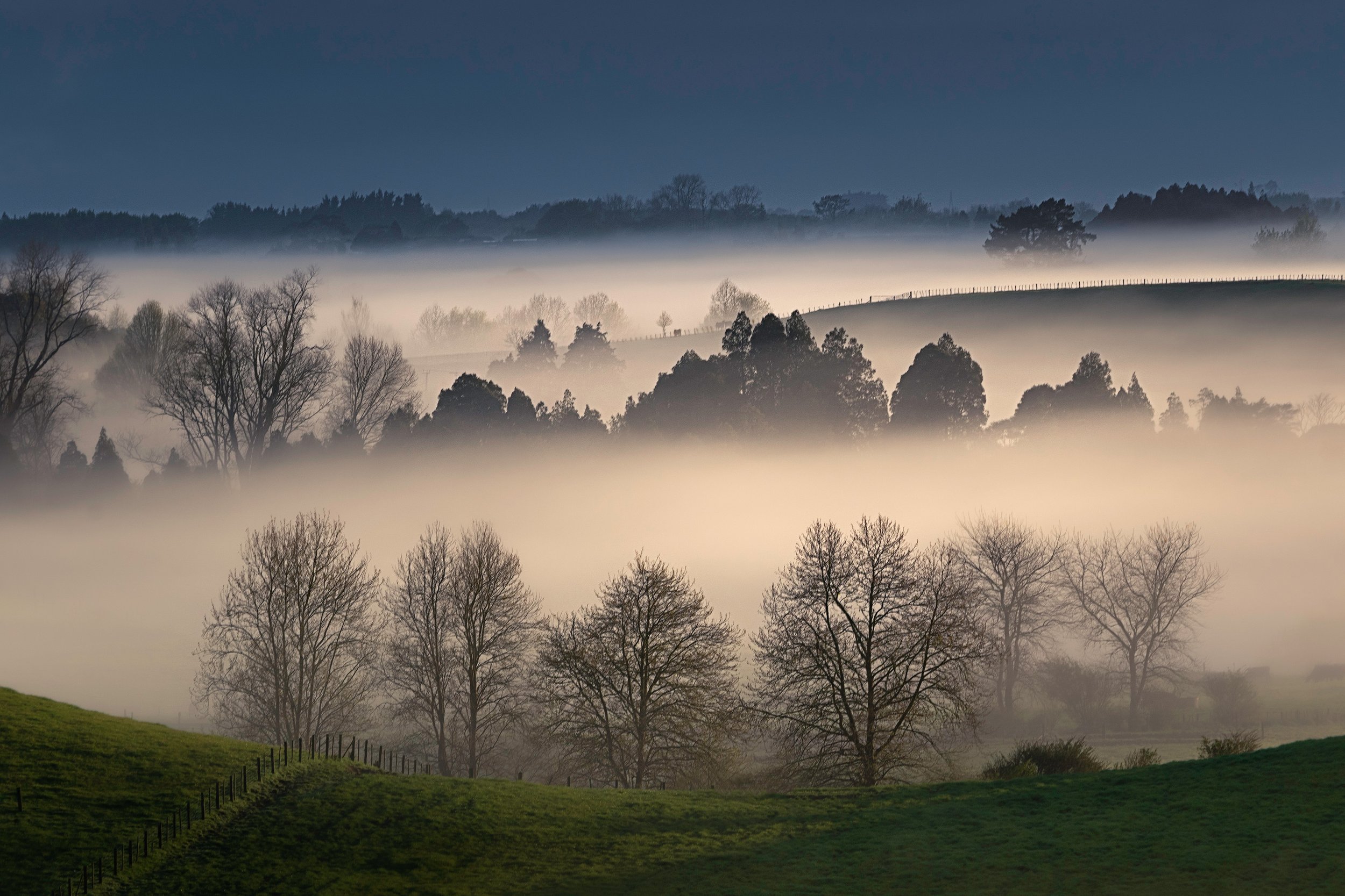
Ethereal Valley - Tukituki Valley, Hawke's Bay
The Science Behind Mist and Fog Formation
Mist and fog form when warm, moist air cools to its dew point—the temperature at which air becomes saturated with moisture, causing condensation. This cooling process can occur due to various mechanisms, depending on the environment and time of year.
Key Factors That Cause Mist and Fog Over Land
1. Temperature Drops
As air cools, it loses its ability to hold water vapor. When the air reaches its dew point, excess moisture condenses into tiny droplets, forming mist or fog.
Rapid cooling is often observed at night or during the early morning when the sun is absent, and the ground radiates heat into the atmosphere.
2. High Humidity
The likelihood of mist or fog increases when the air is already saturated with moisture, such as after rainfall or in areas with high humidity levels.
3. Calm Winds
Gentle or still winds help the cool, moist air stay in place, allowing condensation to occur. Strong winds disrupt the stable air layers needed for mist or fog to form.
4. Geographical Features
Valleys: Cold air tends to sink into valleys, where it cools further, making these locations prime areas for fog formation.
Water Bodies: Lakes, rivers, and wetlands provide abundant moisture, which enhances the chance of mist and fog in nearby areas.
Types of Mist and Fog Over Land
Different processes can lead to the formation of mist and fog. Understanding these types can help you predict when and where they might appear.
1. Radiation Fog
How It Forms: Occurs when the ground loses heat rapidly at night, cooling the air just above it to the dew point.
Ideal Conditions: Clear skies, calm winds, and high humidity.
Common Locations: Open fields, valleys, and flat terrain.
2. Advection Fog
How It Forms: Develops when warm, moist air moves over cooler land. The air cools as it contacts the surface, leading to condensation.
Ideal Conditions: Coastal areas and regions with contrasting air and ground temperatures.
Common Locations: Areas near lakes or where sea breezes meet colder landmasses.
3. Upslope Fog
How It Forms: Created when moist air is forced upward along a slope (e.g., a hill or mountain). The air cools as it rises, causing fog to form.
Ideal Conditions: Mountainous or hilly terrain with consistent air movement.
Common Locations: Mountain foothills and high-altitude areas.
4. Evaporation Fog
How It Forms: Happens when cold air passes over a warm, wet surface, such as a lake or recently rained ground. Moisture evaporates and condenses into fog.
Ideal Conditions: Early morning after a rainstorm or over lakes and rivers in autumn.
Common Locations: Water bodies, wet fields, and marshlands.
5. Freezing Fog
How It Forms: Similar to radiation fog but occurs when temperatures are below freezing. The water droplets remain liquid but freeze upon contact with surfaces.
Ideal Conditions: Winter months in regions with high humidity.
Common Locations: Northern climates, valleys, and areas near water.
Whatawhata Morning Fog - Waikato, New Zealand
Fog in New Zealand
Fog is a common meteorological phenomenon in New Zealand, with several types occurring due to the country's diverse geography and climate. The primary types of fog observed include:
Radiation Fog: This is the most prevalent type in New Zealand. It forms during clear nights when the ground loses heat through radiation, cooling the air above it to its dew point and leading to condensation. Radiation fog is common in inland areas, especially in valleys where cold air settles overnight.
Valley Fog: A subtype of radiation fog, valley fog occurs when cold, dense air settles into valleys, leading to condensation and fog formation. This is typical in regions with significant elevation changes, where cooler air descends into lower areas.
Advection Fog: This type forms when moist air moves horizontally over a cooler surface, such as land or water, causing the air to cool to its dew point. Advection fog is common in coastal areas where sea breezes bring moist air inland.
Certain locations in New Zealand are particularly prone to fog:
Hamilton: Situated in the Waikato region, Hamilton is especially susceptible to fog due to its geography. The city lies in a large, open, relatively flat area where heat can radiate away quickly, leading to frequent radiation fog, especially during autumn and winter.
Christchurch: Located on the Canterbury Plains, Christchurch often experiences radiation fog, particularly in the cooler months when clear nights allow for rapid cooling of the land surface.
Invercargill: As one of the southernmost cities, Invercargill records a significant number of fog days annually, with an average of 41 days per year. The city's proximity to the ocean and flat terrain contribute to the frequent occurrence of fog.
Hawke’s Bay: See below.
Fog and mist in Hawke’s Bay
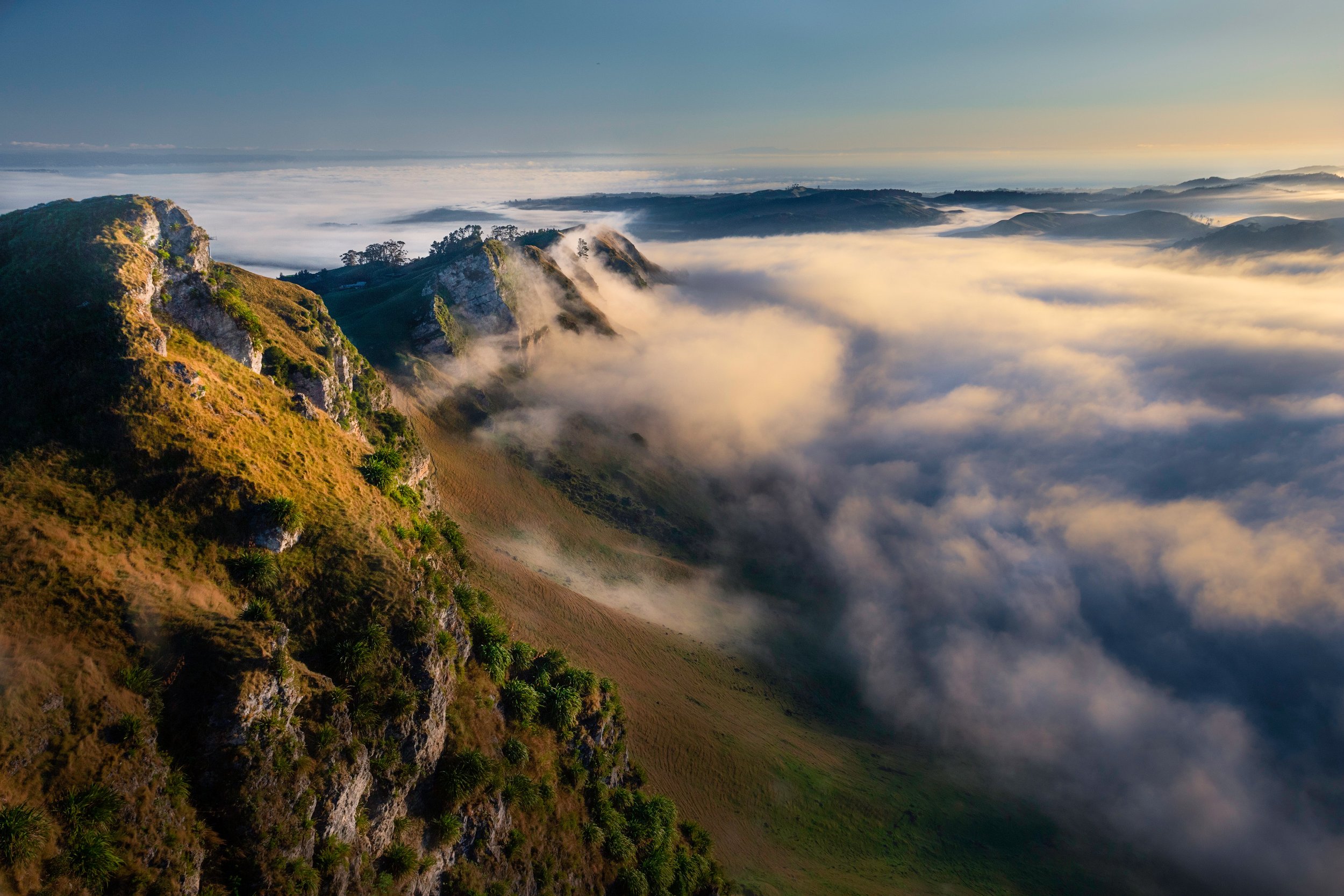
The climate of Hawke’s Bay is influenced largely by the physical geography of the region and the airstreams crossing New Zealand. It is a sunny region with most areas having over 2000 hours of sun per year, and highly variable and sporadic rainfall. The region is less windy than many other coastal areas of New Zealand, experiencing very light winds. Consequently, the clear skies and minimal wind often causes frosts and fog during the cooler months of the year.
The most common type of fog in the Hawke’s Bay region is radiation fog, formed when the air cools to its dewpoint on clear nights, allowing the water vapour in the air to condense. Fogs also sometimes form when the humidity of the air near the ground has been raised by falling rain. Although fog can occur at any time of the year it is recorded most frequently between March and August.
Morning fog climbing up Te Mata Peak - Hawke's Bay, New Zealand
How to Predict Mist and Fog
While predicting fog isn’t an exact science, several tools and environmental cues can help you anticipate its formation. Here’s a step-by-step approach:
1. Check the Weather Forecast
Modern weather forecasts often include fog predictions, which are based on factors like temperature, humidity, and wind speed. Look for:
Clear Skies: Radiation fog is more likely on nights with minimal cloud cover.
Temperature Drops: Check if nighttime temperatures are expected to approach the dew point.
High Humidity: Relative humidity levels above 90% greatly increase fog potential.
Calm or Light Winds: Speeds below 5 km/h (3 mph) are ideal for fog formation.
2. Use a Hygrometer
A handheld hygrometer can measure relative humidity in real-time. If the reading nears 100%, fog is likely to form if temperatures drop.
3. Observe Geographical Indicators
Valleys and Depressions: These areas tend to collect cooler air, making them more prone to fog.
Nearby Water Sources: Locations near lakes, rivers, or wetlands often have higher humidity, increasing the chance of fog.
4. Monitor Dew Point and Temperature
Dew Point Thermometers: These devices allow you to track the dew point temperature, helping you determine if conditions are right for condensation.
Temperature Trends: A rapid drop in temperature after sunset is a strong indicator of fog development, especially in calm, humid conditions.
5. Understand Seasonal Patterns
Certain times of the year are more conducive to fog:
Autumn: Cooler nights and lingering moisture from warm days create perfect conditions for mist and fog.
Winter: Freezing fog is common in colder months when temperatures dip below freezing.
Spring: Morning fog can form due to temperature contrasts between land and water.
6. Leverage Satellite Data and Fog Maps
Websites and apps provide real-time satellite imagery and fog density maps. These tools are particularly useful for tracking advection fog or widespread fog events. Examples of apps that could be useful: Windy, MetService - New Zealand Weather App, meteoblue.
7. Look for Visual Cues
Mist Formation: If you see light mist forming close to the ground in the evening or early morning, it may thicken into fog as temperatures drop further.
Ground Cooling: Dew on grass and cold, still air are precursors to fog formation.
Practical Tips for Finding and Capturing Fog
For those interested in experiencing or photographing fog, understanding when and where it forms is just the first step. Here are a few tips:
Arrive Early: Fog is most common just before and shortly after sunrise.
Scout Locations: Visit areas with valleys, water bodies, or open fields for higher chances of fog.
Dress Warmly: Foggy conditions often coincide with chilly temperatures, so layers are essential.
Be Patient: Fog can be unpredictable, so give it time to develop.
Treetops, Mist, and Sunlight - New Zealand
Conclusion
Mist and fog over land are mesmerising natural phenomena caused by the cooling and condensation of moist air. By understanding the types of fog, their causes, and the conditions needed for their formation, you can increase your chances of experiencing these atmospheric wonders. Whether you’re a photographer chasing dreamy shots or simply an admirer of nature’s beauty, predicting fog becomes an exciting and rewarding skill.
Sources used for this article include: MetService, Niwa


This article explains what a Circular Polarising Filter (also known as a CPL filter) is, and shows results of an in-depth test to determine if they make a genuine difference to landscape photography. And I made an unexpected discovery!