A 20-day photography tour around Iceland
This article presents a visual, 20-day journey through the enchanting autumn landscapes of Iceland in September 2023.
Iceland is the land of fire and ice; a land shaped by volcanic activity and glaciers. This Nordic island nation had been on my list of dream destinations for a long time, as its distinctly-shaped mountains, moss-covered lava, iconic waterfalls, accessible glaciers and iceberg-occupied lagoons are a landscape photographer’s paradise. The prospect of witnessing the ethereal Aurora added even more attraction.




Encompassing around 103,000 square kilometres and hosting just under 400,000 residents, Iceland stands at less than half the size of New Zealand, rendering it a sparsely populated country. While researching, the abundance of photogenic places strewn across the landscape appeared nothing short of astonishing. We, my wife and I, wanted to explore the entire country, but despite our extended stay of over three weeks, we had to make strategic choices. We also needed some flexibility to quickly respond to Iceland’s unpredictable and ever-changing weather. Thus, we opted for a motorhome, deeming it the ideal mode of transport to navigate the diverse terrain and stay close to various photo spots.
It turned out to be a good choice, and we visited most of our ‘must-see’ spots, while also enabling us to escape any bad weather when required and discover previously unknown gems.
Our plan was to travel around Iceland, following Route 1 or the Ring Road, which is the main road in Iceland that circles the entire country, in a clockwise direction. So, after our first night we drove up from the southern peninsula where the airport is, through Reykjavik, to the Snæfellsnes Peninsula at the west coast. After that, we travelled from there through the northern region to the east, before exploring the south and returning to Reykjavik.
The Ring Road is 1368km long. We drove 3441km over 20 days, so that is 172km per day, as we frequently exited the main road to visit attractions.
We travelled in a motorhome that we had hired from McRent and we stayed at 20 different places ranging from camping grounds to public car parks.
Snæfellsnes Peninsula
Snæfellsnes is the long and narrow peninsula sticking out of Iceland into the North-Atlantic Ocean to the west. The drive from Reykjavik to this peninsula is quite spectacular, with lots of rough, rocky lava remains and mountains in the background. And there are several waterfalls along the way, with the highlight being one particular waterfall at Helgafellssveit, called the Sheep’s Waterfall, that is hidden from the road. One of the main attractions of the Snæfellsnes Peninsula is Kirkjufell, a distinctly shaped mountain made famous by photographers.
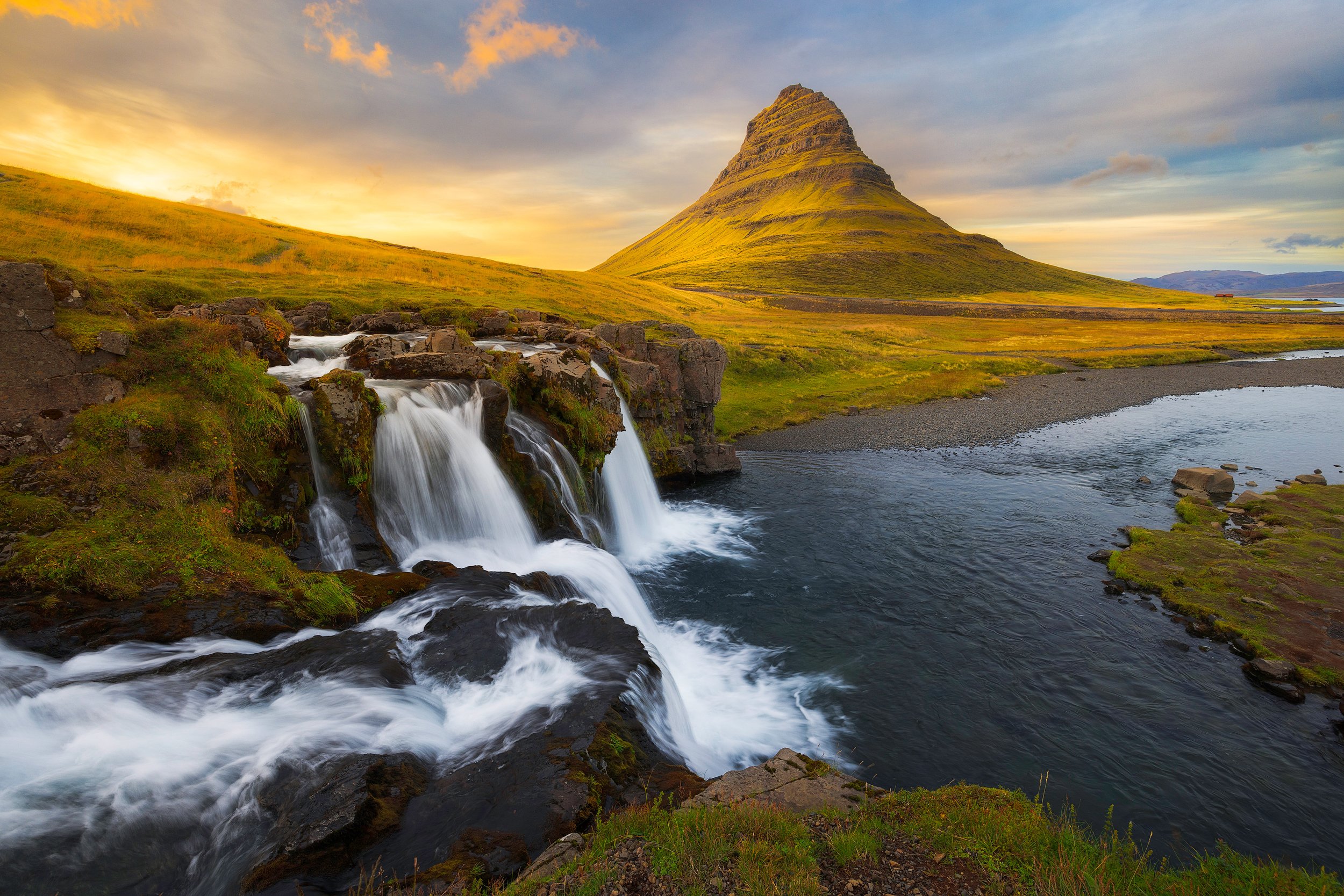
Kirkjufell's Temptation - Snæfellsnes Peninsula.
Resisting the urge to photograph Kirkjufell mountain is like trying to turn down a glass of Syrah at the end of the day, a temptation that's nearly impossible to resist. Even though I had told myself that I wouldn't succumb to capturing an image that countless others had already taken, I found myself standing in awe of this iconic mountain, its unique silhouette framed by the cascading waterfall in the foreground. And the scenery was just too good to leave my camera in the bag.
As the golden hour bathed the landscape in its enchanting glow, I experimented with different angles and compositions, searching for that one shot that would add a personal touch to this timeless vista. As I worked my way down to the lower tier of the waterfall, I found a view that encapsulated the magic of Kirkjufell during this beautiful time of day. And the awesome light helped :-).
We spent 2 nights in the peninsula, basically making our way around Snæfellsjökull, a glacier-capped stratovolcano that is the crown of the national park with the same name. There was so much to see: beautiful and diverse landscapes including a coastline with spectacular cliff formations at Arnarstapi and black and golden beaches. But the moss-covered lava fields and numerous beautifully shaped volcanic craters and lava tube caves were the most fascinating. You want to stop every 5 minutes, but you wouldn’t get anywhere if you did that…
Volcanic Autumn Embrace - Snæfellsnes Peninsula.
A volcanic landscape in autumn splendour, taken at Rauðhóll (‘Red Hill’) on the Snæfellsnes Peninsula.
Svörtuloft Lighthouse - Snæfellsnes Peninsula.
Bugsfoss - Snæfellsnes Peninsula.
Svöðufoss - Snæfellsnes Peninsula.
Golden sand and Black Seaweed - Skarðsvík Beach.
Seastacks near the Svörtuloft Lighthouse - Snæfellsnes Peninsula.
The Cliffs of Lóndrangar - Arnarstapi, Snæfellsnes Peninsula.
Northern Lights at Hvítserkur
One of the reasons why we went to Iceland in autumn was the chance to see the Northern Lights or Aurora Borealis, because that’s when these waves of light become visible.
Following the arctic island in a clockwise direction, our next stop was Hvítserkur, otherwise known as the Troll of Northwest Iceland. We had just arrived at our parking spot for the night when a notification popped up on my phone that the aurora could be visible during the night, if there were no clouds above us. So, we got up at 2am to have a look at the sky. We were lucky. We could see the lights with our bare eyes, although they were looking quite white. We walked to Hvítserkur for it to act as the foreground. And as soon as I looked at a preview on my camera, I knew this was going to be fantastic.
Grazing under the Northern Lights.
The Aurora Borealis over Húnaflói (Huna Bay) towards the lights of Blönduós and Skagaströnd with the Hvítserkur seastack in the foreground.
I wanted to have the seastack more prominent in the photo and decided to get closer by climbing down to the beach, which was a bit of a challenge in the dark. I shot throughout the night, moving my camera regularly to try different compositions and to move with the light (because it does really dance).
Feeding on Light.
Hvítserkur (Hvitserkur), a 15m high basalt stack in the north of Iceland that is often described as a dragon or troll, appears to be feeding on the Aurora.
Hvítserkur Aurora.
The Aurora Borealis gracing the night sky above the legendary Hvitserkur sea stack in the northern reaches of Iceland. The vivid streaks of colourful light emanating from the aurora appear as if they were cascading upon this enigmatic creature, forever frozen in stone.
Ring of Aurora Light above Hvítserkur.
The variety of light shapes during the night was just incredible.
Note to self: next time take two cameras; one for a timelapse and one for stills.
The northern lights began to fade at around 4am, but I decided to hang around for sunrise, because it was too difficult to climb back up in the dark. However, it was worth the wait, and I got another memorable image with the sun rising in between the legs of the frozen sea creature. It was cold though, and when I came back to the camper, I noticed that the puddles in the carpark had frozen over. That explained why my feet were cold after they got wet while walking through the sea water. What a night it was, and I’ll never forget the experience to be able to witness these dancing lights.
Hvítserkur Sunrise
As the sun ascends, its golden rays pierce through the natural arch formed by Hvítserkur’s head and legs, creating a sunstar effect.
North Iceland
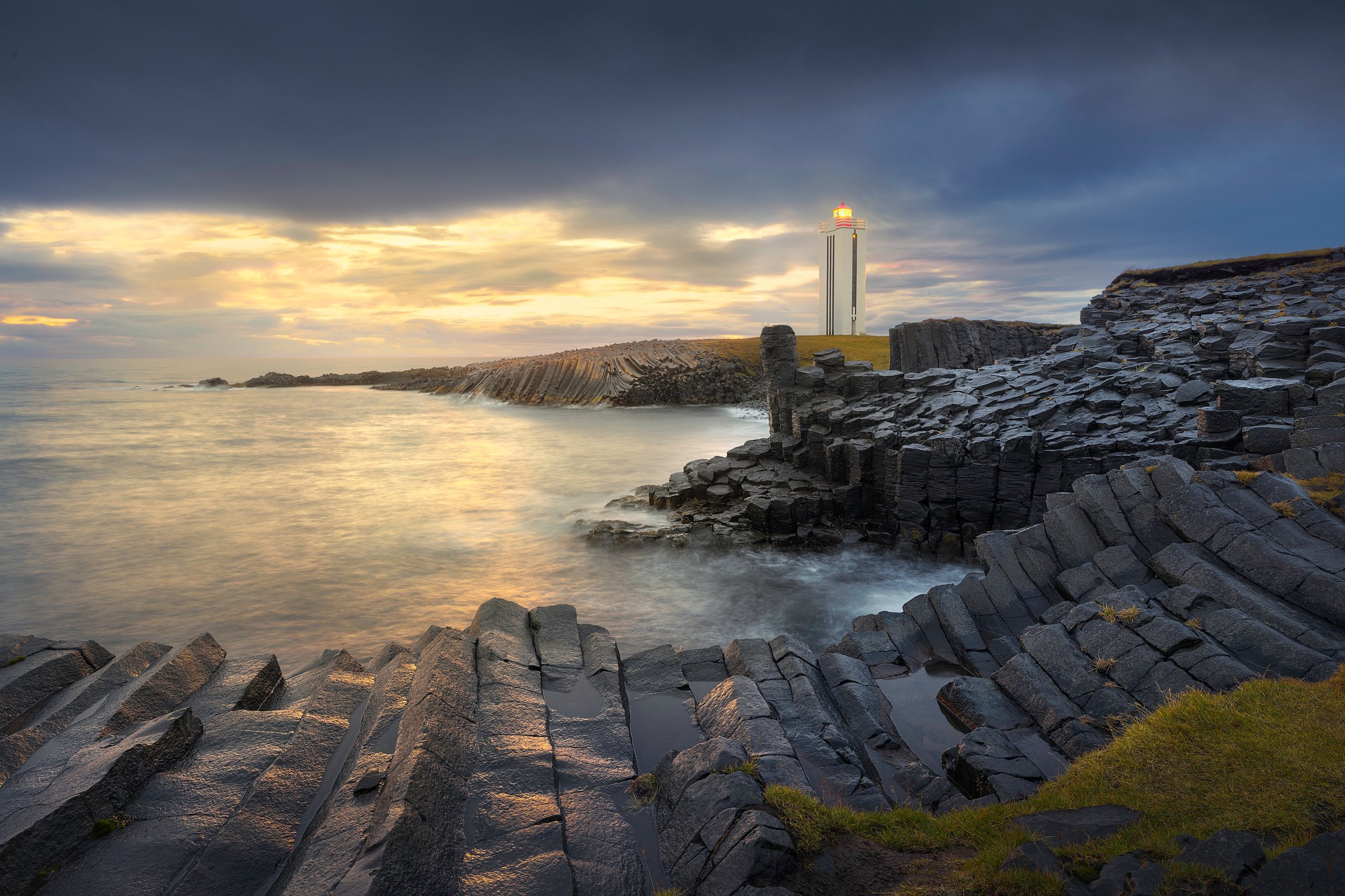
After Hvítserkur, we continued our journey through North Iceland, following the Húnafjörður bay via Blönduós (Blonduos) towards Kálfshamarsviti where we stayed the night. It was overcast and raining when we arrived, but we were entertained by sheep grazing seaweed (instead of grass). We cooked dinner, and while doing the dishes, the colour of the sky changed as the sun was setting. Time to rush towards the lighthouse and the unusual, beautifully formed sea cliffs of columnar rock, created about 2 million years ago.
Standing Tall - Kálfshamarsvík.
The striking basalt columns of Kálfshamarsvík. The lighthouse, with its distinct architecture, adds a touch of human history to the natural beauty of the landscape.
Kálfshamarsvík was once a bustling fishing station and small village, but by around 1940, the settlement had become deserted. Ruins of various houses from that time can still be seen in the area.
Although it’s possible to get further north, Kálfshamarsvík was the closest to the arctic circle we would get on our trip. The next morning, we continued our journey and visited Akureyri, the “Capital of North Iceland“ and the largest city outside the Reykjavik region, where we walked around the centre and visited a couple of art galleries. We arrived at Godafoss in the late afternoon. It was raining and there wasn’t any light for a sunset shoot, so I did some scouting for compositions for the next morning.
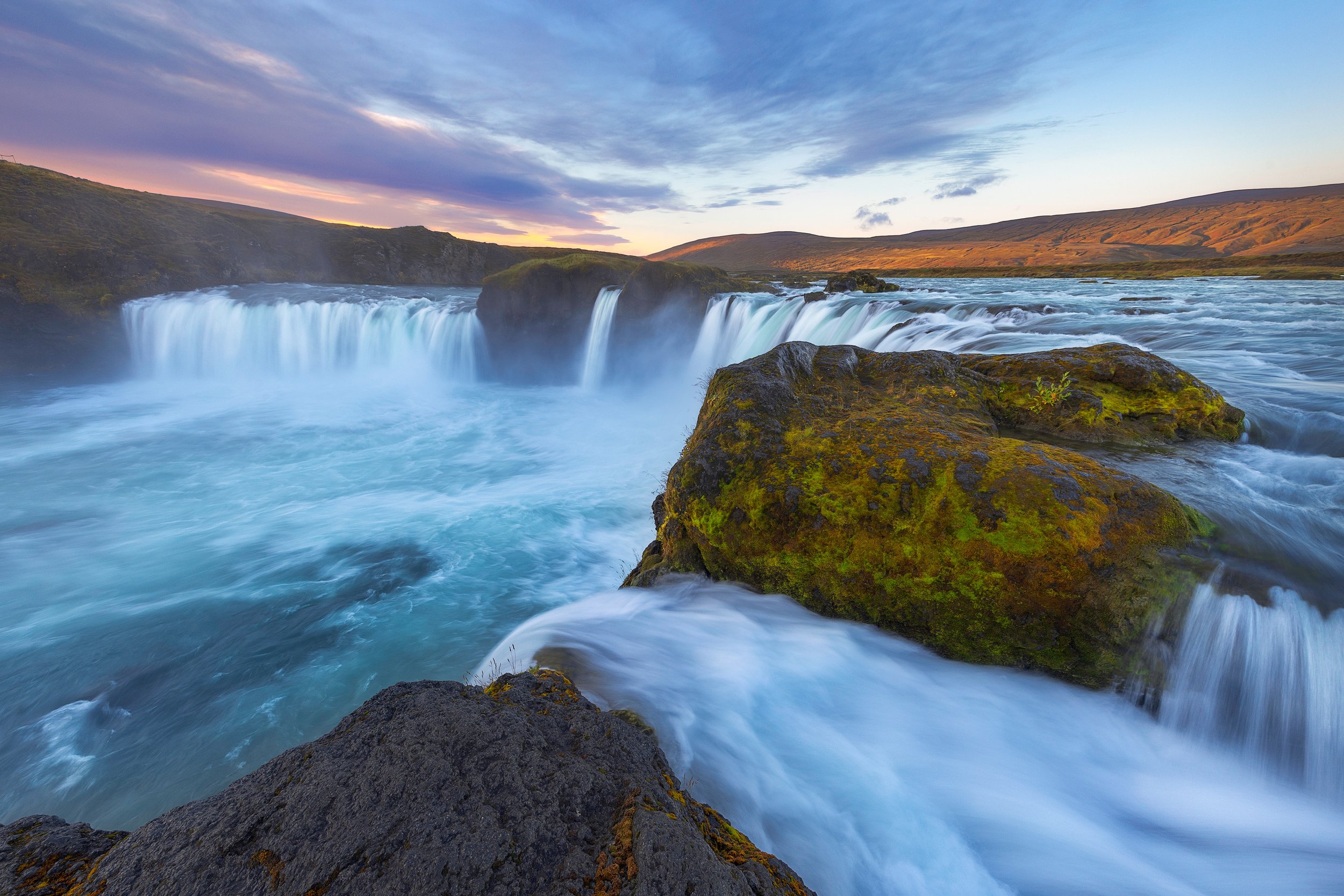
The rain cleared overnight and I got up at 6am to shoot the sunrise. I was the first to arrive and got as close to the falls as I could. There was nice colour in the sky behind me, but the sun never came through. However, I was in awe of this spectacular natural wonder.
Waterfall of the Gods - Goðafoss.
The "Waterfall of the Gods" is a poetic nickname given to Goðafoss, a prominent waterfall located in northeastern Iceland. The name is rooted in Icelandic history and legend.
Godafoss is a symbol of Iceland’s transition to Christianity and is the location of a myth where a historic leader, in the year 999 or 1000, threw his Norse god statues into the waterfall after making Christianity Iceland’s official religion.
The next stop was Húsavík, an old whaling town that now offers whale watching tours and has a very informative Whale Museum. Húsavík is part of the Diamond Circle sightseeing route in northeast Iceland that showcases the region’s most magnificent spots. Other sites on this route are Lake Mývatn, the Dettifoss Waterfall, and the colourful Ásbyrgi Canyon.
The Dark Fortress - Lake Myvatn.
Dimmuborgir, or the Dark Fortress, is an area of dramatic lava rocks just east of Lake Myvatn. Often compared to a castle, it has columns that resemble towers, ridges that rise like battlements, and caves that tumble deep into the earth like dungeons.
Golden Vista - North Iceland.
A panoramic view of the golden, autumn landscape in the northeast of Iceland.
Dark Dettifoss - North Iceland.
Dettifoss is Europe’s most powerful waterfall, with a thunderous flow plunging into a canyon. Even on a rainy day with gale-force winds that make it very difficult for a long exposure, the sheer force and scale of this waterfall are awe-inspiring.
Eyjan Glow - Ásbyrgi.
The view of the colourful Ásbyrgi canyon from the top of Eyjan Hill.
Rainbow at Ásbyrgi - North Iceland.
I rate Ásbyrgi as one of the most magical places in Iceland when visiting in autumn. Despite the challenging weather we encountered, with gale force winds and relentless rain, the autumn hues and serene atmosphere rendered the experience truly indescribable. And if you are patient, the ever-changing Iceland weather will usually come out to play…
East Iceland
Driving in Iceland presents an ever-evolving adventure. The scenery transforms continually, matching the ongoing shifts in weather. During our journey along the East Iceland fjords, we encountered particularly adverse conditions, subjecting us to the unforgiving elements – gale force winds and unyielding rain were our constant companions. Worst of all (at least for a photographer), we gazed at a perpetually overcast sky, draped in a monotonous, oppressive gray.
Driving the Ring Road - East Iceland.
However, as they often say, the weather in Iceland is among the most fickle aspects of this land. In a fleeting, magical instant, the sky defied its gloom and breathed life into the rugged terrain, casting a radiant light upon the mountain. Only moments later, the sky once again veiled itself, and we pressed on towards the next clearing on our journey.
Weathering the Storm - East Iceland.
Although the weather was bad with severe wind gusts and endless rain, the scenery while driving along the fjords was spectacular with lots of waterfalls coming down the steep mountains.
Endless Waterfalls - East Iceland.
Rainbow at the Fjord - East Iceland.
Steep, Colourful and Wet - East Iceland.
We made it to Hvalnes Beach where we had intended to stay for a few nights to capture the Eystrahorn and Vestrahorn Mountains. However, after a quick snapshot of Eystrahorn we decided to move on to escape the weather.
South Iceland
At Höfn, a small fishing town in the southeast of Iceland, we had our first panoramic view of Iceland's Vatnajökull, which is the largest and most voluminous ice cap in Iceland with its glaciers coming down to sea level. The snow-capped mountains and outlet glaciers were so inviting that you just had to get closer to them. And so, we drove further along the Ring Road to the Jokulsarlon Glacier Lagoon (Jökulsárlón). There are a number of large carparks here, because it’s also home to Diamond Beach, which is a popular tourist attraction.
Initially, I concentrated on the icebergs floating in the lake and shot the sunset there as well. It was a colourful evening, but it was tricky to find a good composition. But once I got my tele lens out, it become easier to find order in the iceberg chaos.
Glacial Spire - South Iceland.
This twisted spire of ice adds a touch of whimsy and individuality to the frozen landscape that is Iceland's Jokulsarlon glacier.
The next morning, it was time to find some diamonds on the beach. I had read that you had to be careful at the Iceland beaches, because the sea waves are unpredictable. I can now say that I have experienced that firsthand, as one of the waves took me by surprise, coming towards me so quickly that it washed over my tripod that I had positioned low to the ground to capture a small iceberg. My camera got wet and so did I, but luckily everything still worked.
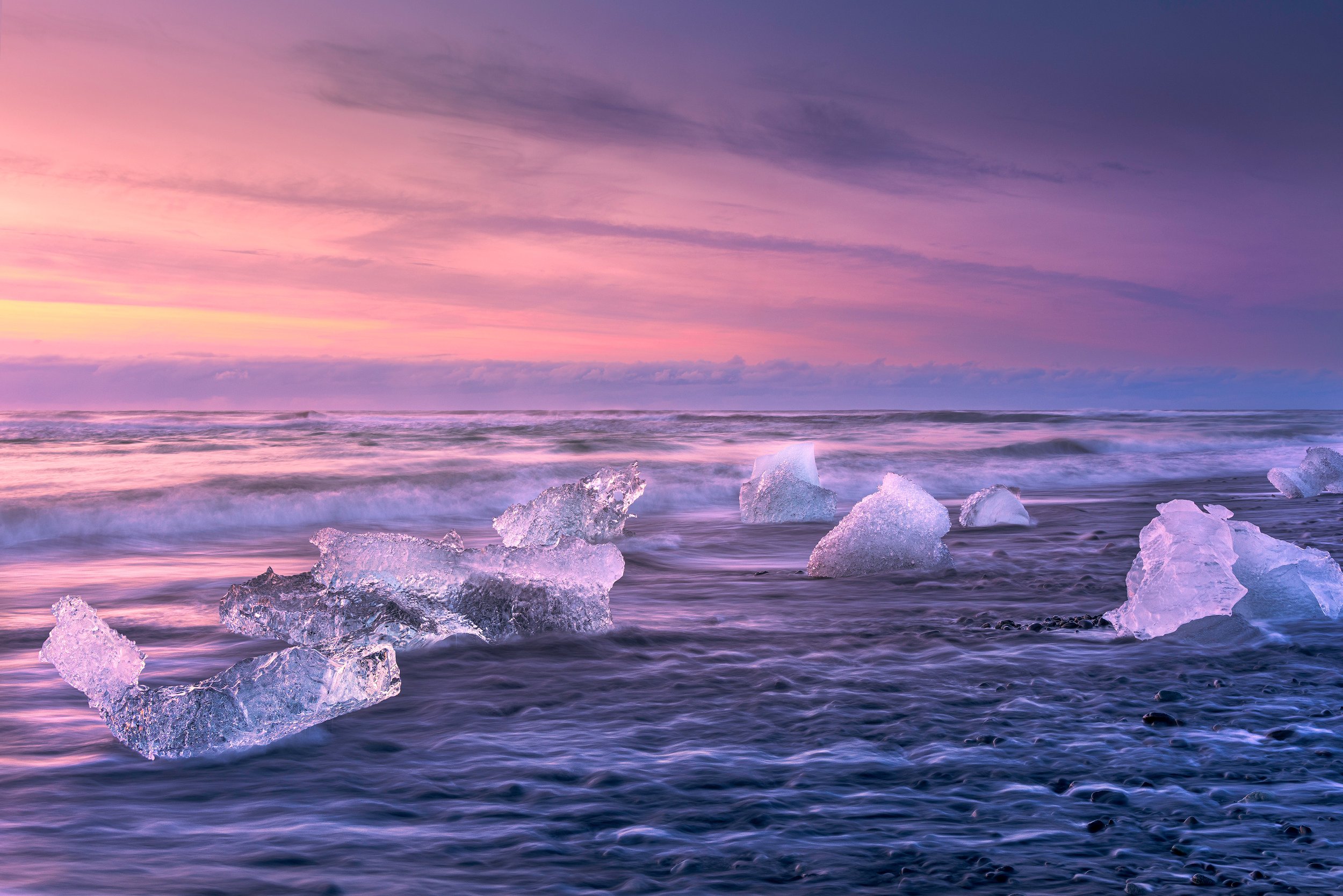
Diamond Beach Dawn - South Iceland.
This scene blends glacial ice that glistens like large, scattered diamonds on the black volcanic sands of Iceland’s Diamond Beach, with the rushing waves of the ocean softened by a long exposure.
Glacial Diamond - Jökulsarlon Beach, Iceland.
As the sun was rising over the horizon, its warm light spilled across the waves and Jökulsarlon Beach. The beach was adorned with a scattering of small icebergs - each one a frozen masterpiece carved by nature with edges reflecting the sunlight like scattered diamonds.
We spent the next few days exploring the various glaciers and lagoons. I found the experience unforgettable. A particular moment that stood out was an evening at Fjallsárlón when the lagoon was slowly freezing over, so that ice patterns began to show. It was so quiet and peaceful, and all you could hear were the drips of the icebergs and the occasional splash of the ice falling from the glacier into the water.
Reflections at Fjallsárlón - South Iceland.
Reflections of little icebergs with the tongue of a the Fjallsjökull glacier outlining the shape of a heart in the background.
Blue Bergy Bits - South Iceland.
The reflection of little icebergs, called bergy bits, in a glacier lagoon.
Glacier Terminus - South Iceland.
The terminus, the end of a glacier, of the Svínafellsjökull glacier.
Skaftafell Glacier - South Iceland.
Skaftafellsjökull is an outlet glacier that runs down a deep valley and is about 10 km long and about 2 km wide.
Öræfajökull Glacier Panorama - South Iceland.
Driving along the south coast of Iceland offers breathtaking views of glaciers, rugged landscapes, and natural wonders.
After the glacier experience it was time to escape the heavy rain that had arrived and drive 390km towards some stunning waterfalls in the southwest.
Cerulean Cascade - Brúarfoss, South Iceland.
Although Brúarfoss ('Bridge Falls') is a relatively small waterfall compared to many of its Icelandic counterparts, it's beautiful, and the blue water, its original source tracing back to the Langjökull glacier, in combination with the autumn colours of the flora are simply stunning.
Blue Flow - Brúarfoss, Iceland.
Brúarfoss Streams - South Iceland.
It was at the top of my 'must-capture' places when I planned my visit to Iceland for September '23. This coincided with autumn, and I was advised that this season brings out wonderful colours around Iceland. I wasn't disappointed and I think this is my favourite waterfall in Iceland (or perhaps anywhere).
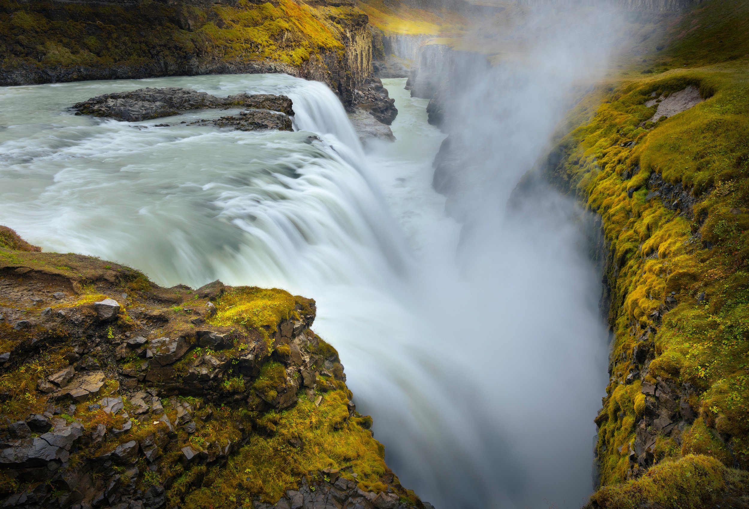
Into the Abyss - Gullfoss, Iceland.
Standing at the edge of the waterfall, one can feel the raw power of nature as torrents of water thunderously plunge into the abyss below.
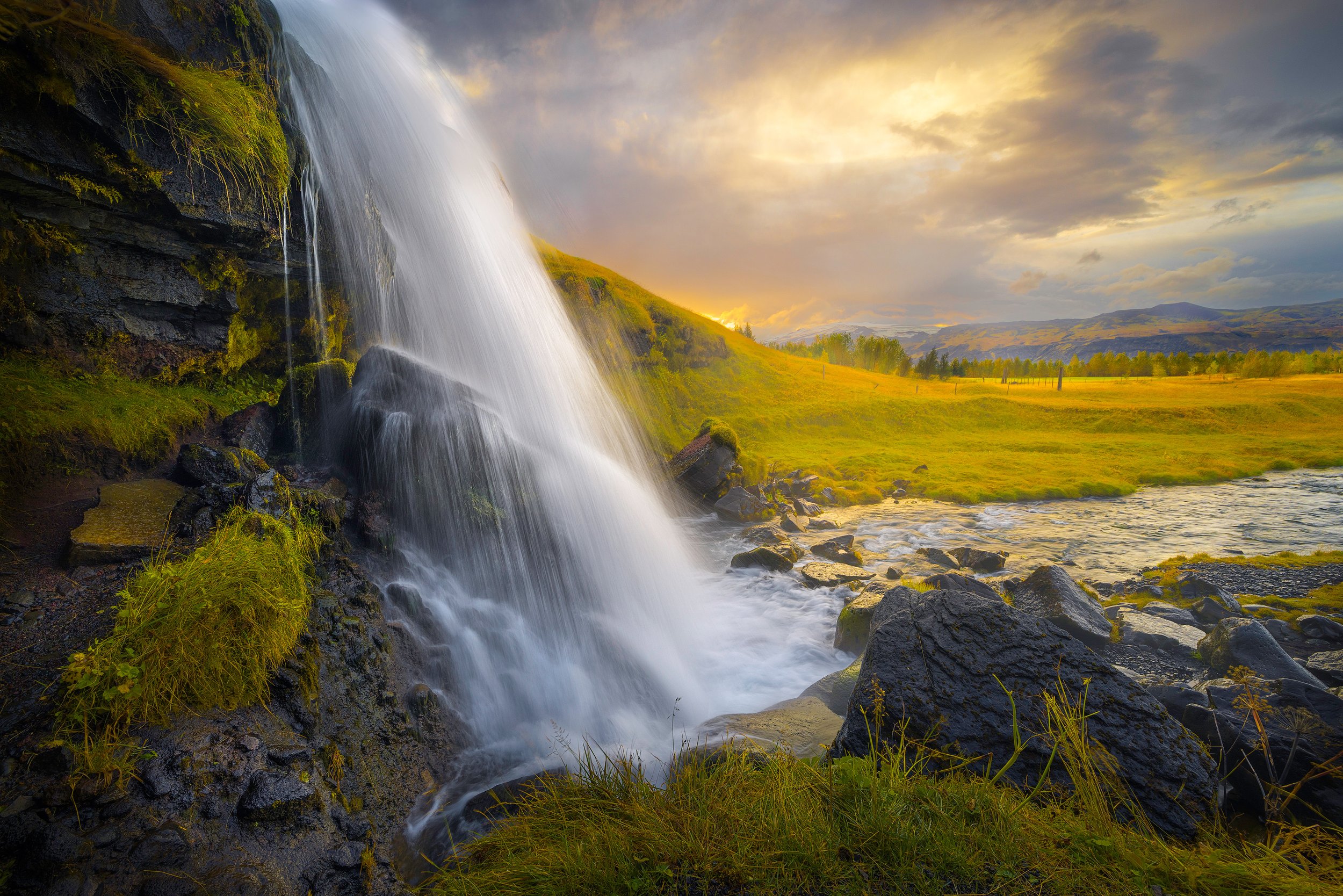
Morning Light at Gluggafoss - South Iceland.
I discovered this composition amidst the enchanting surroundings of Gluggafoss waterfall during the early morning hours. Despite initially encountering a somewhat subdued scene due to overcast skies, a transformation unfolded as I retreated to our mobile home for breakfast. The clouds began to part, revealing a stunning spectacle as the sun ascended above the distant Eyjafjallajokull glacier. Fueled by this dramatic shift in lighting, I hurried back to my vantage point to capture a photo of this breathtaking scene.
Reykjanes Peninsula
It was time to leave the glaciers and waterfalls behind and go towards the southwest of Iceland, the Reykjanes Peninsula. The peninsula is marked by active volcanism under its surface and large lava fields, which is evident wherever you look. We stayed at the camping ground in Grindavik, a small fishing town that was severely impacted by earthquakes and volcanic eruptions after we left Iceland.
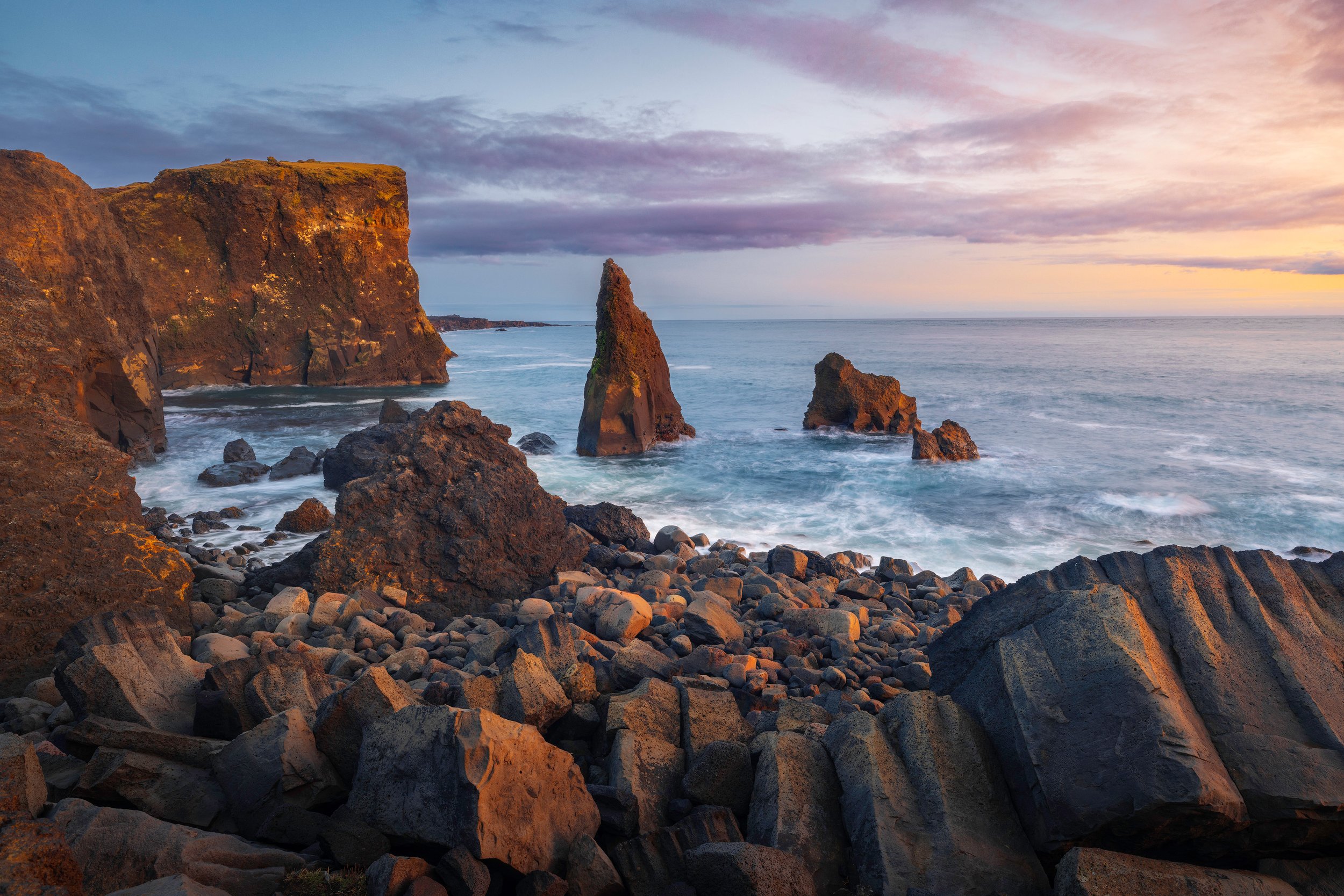
Valahnúkamöl Cliffs - Reyjanes Peninsula.
The cliffs at Valahnúkamöl were quite incredible. This site of volcanic origin features a rugged coastline, battered cliffs, crashing waves, and sea stacks rising out of the sea.
A great place to walk around and see the effect of volcanic activity close to water, with so many different textures, including the nicely rounded stones at Valahnúkamöl Beach, and a sea-stack called Karlinn, an ancient crater plug, in the distance.
Valahnúkamöl Beach - Reyjanes Peninsula.
And then we had one last, but very memorable night before returning our mobile home and spending a few days exploring the city of Reykjavik.
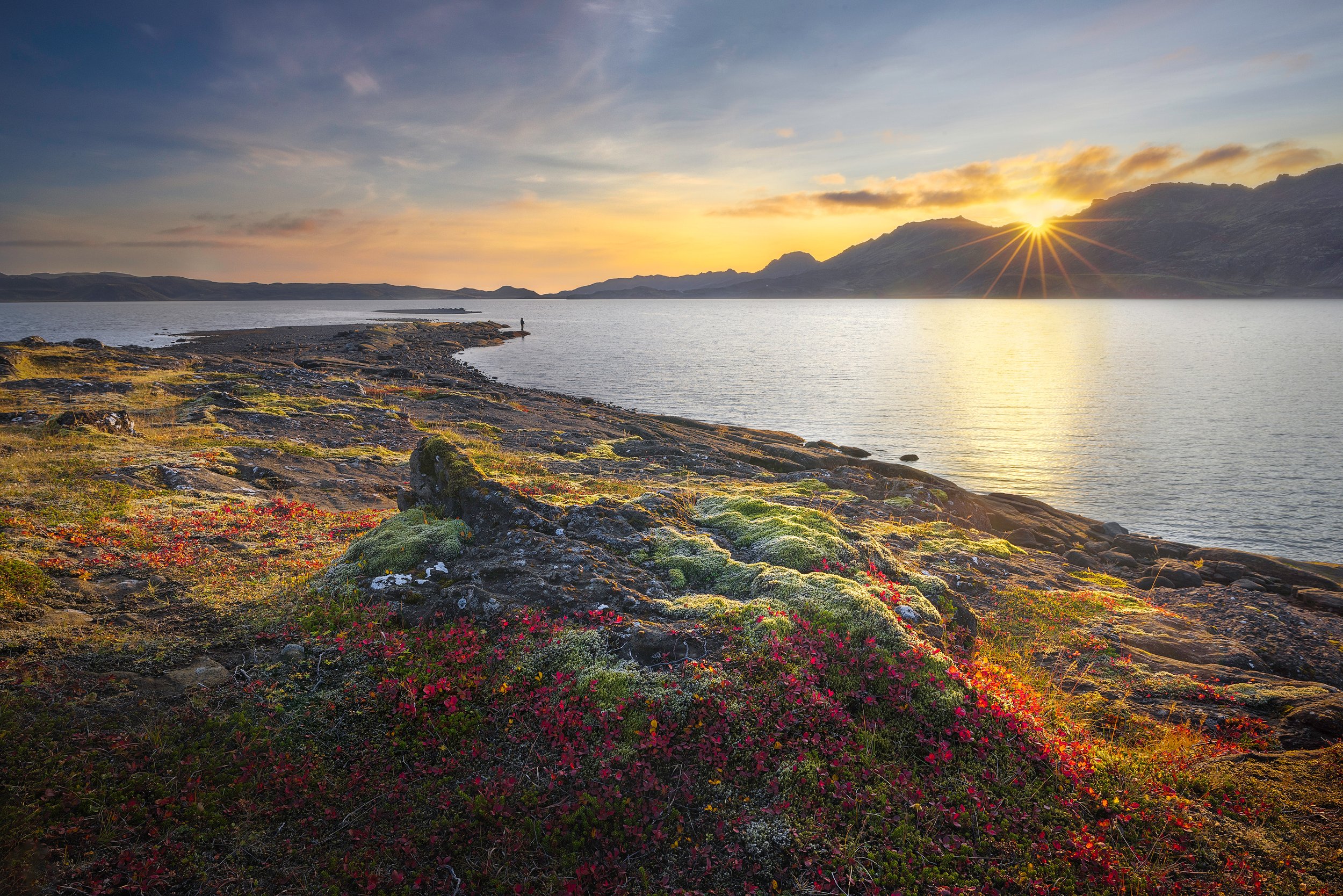
Kleifarvatn Sunset - Reykjanes Peninsula.
The vibrant autumn flora in Iceland cast an irresistible spell on me when I was there is September, and my camera simply couldn't get its fill. My enchantment reached its peak when I was at Kleifarvatn, which is a beautiful lake, about 10km away from Grindavik on the Reykjanes Peninsula..
We experienced such a calm sunset there with wonderful light that brought out the colours of the flora covering its volcanic and rocky shore.
This appeared to be a favourite spot for friendly, local fishermen hoping to catch trout who may have been wondering why I was there with my camera and tripod rather than a fishing rod. One such fisherman has found his place in the frame.
Thanks for reading and viewing and I hope you got a good impression of our time in Iceland, and the beauty we witnessed.


This visual journey follows Northland’s Twin Coast Discovery Highway, taking you through the Kauri Coast to the Far North, before returning via the Bay of Islands to Whangārei. Travelling in our motorhome, we dedicated two weeks to thoroughly revisit familiar spots and uncover new ones.